As a kid in the 1970s, I marveled at the shiny dome of granite at Enchanted Rock State Natural Area, which looked to me like the shell of an enormous, pink, half-buried tortoise. Climbing Enchanted Rock seemed almost unfathomable, like scaling Everest, and I half expected to see tiny pixies waving magic wands when I looked for fairy shrimp in the vernal pools that pocked its surface.
Fifty years later, it still feels a little mystical—only now there’s more to explore. With the purchase of a 630-acre ranch to the south and a 3,073-acre ranch to the north, the state natural area has roughly tripled in size.
Enchanted Rock State Natural Area
16710 Ranch Road 965,
Fredericksburg. 830-685-3636; tpwd.texas.gov
For now, there is no public access to the south addition other than occasional public hunts and ranger-led hikes. But in July, the northern parcel, also known as the Backcountry Area, opened for day use. On a sizzling day in late September, I hotfooted it there to explore.

“One of our goals is to spread people out, because we were so concentrated at Enchanted Rock proper,” Superintendent Doug Cochran told me at park headquarters.
For now, just reaching the edge of the northern terrain requires a 2-mile walk. But construction is set to begin soon on a new Backcountry Area entrance north of the park’s main entrance. By early 2027, visitors will be able to drive to a 40-vehicle parking lot where they can access 10 miles of existing ranch roads—and, eventually, new single-track trails.
Cochran pointed me toward a gravel road, the Red Shouldered Route, where he promised I’d find sweeping Hill Country views. (In the interest of saving miles on a 100-plus degree day, he led me partway back by vehicle.)
I loaded water into my pack, then headed down a gravel road lined in places with baseball-size chunks of glittering quartz. A lizard skittered across a granite outcrop as large as a Volkswagen, and prickly pear bristled along a hillside. It looked like the set of a Hollywood western.
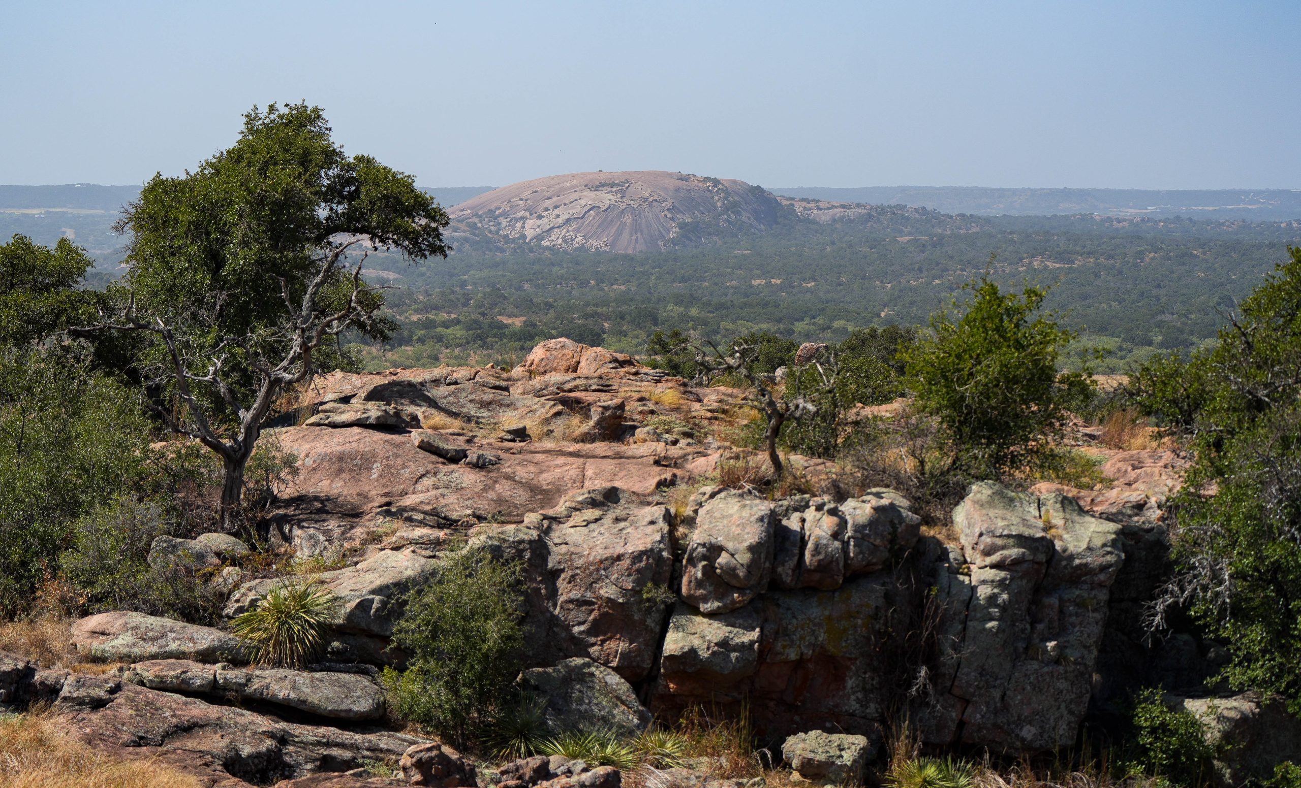
At the top of the hill, I clambered onto a granite formation, then gazed back at the park’s famous batholith, formed more than a billion years ago when molten magma below the earth’s surface pushed up into the rock above it and hardened.
Here was a view I hadn’t seen before, one worth the hike to get there. From this perspective, it’s easy to see that the main rock dome isn’t the only one; it’s just part of a 62-square mile, mostly underground rock formation that breaches the surface in multiple spots. Around me, smaller domes arched out of the scrub.
The new view was a highlight, but not the only one. I stopped by Aplite Pond to the east, where clouds of dragonflies hovered along the shoreline and a few frogs about the size of a quarter each hopped into the water. It’s a good spot to cast a line for sunfish or small bass.
A few other changes are coming. The park’s main entrance station will relocate to the south addition, where additional developed campsites are also planned. The existing headquarters and entrance station will be repurposed into a camp store. Officials are talking with members of the Central Texas Climbing Committee to identify potential bouldering spots, too.
I’m most excited about the host of new views of that famous Texas dome I’ve been looking at for half a century. And when this new section of the park opens, I’ll be able to string together an easy, multiday backpacking trip that delivers just that.