Five Scenic Texas Road Trips to Take This Year
These leisurely routes prove that taking the long way is worth the distance
FORT WORTH TO MINERAL WELLS
At Your Leisure
Retracing childhood drives west of Fort Worth
By Dina Gachman
As a kid growing up in Fort Worth during the late 1970s and early ’80s, a Sunday drive with my maternal grandfather, Pampaw, was as exciting as a trip to Six Flags. Instead of spinning in circles on rides like El Sombrero, I would hop into the front seat of Pampaw’s beige 1965 Chevy Stepside. He’d back out of his driveway on Modlin Avenue, heading west toward towns like Mineral Wells and Graham. Sometimes our destination was a relative’s farm, but often our trips were free of set times and specific goals. Pampaw didn’t have a road map, and I didn’t have a single distraction. My screen was the world outside the window, my entertainment the North Texas vistas and towns I spied from the truck.
Pampaw died in 1988, so it’s been decades since our last Sunday drive. To recapture some of those childhood memories, I take off from my sister’s home near the Texas Christian University campus on a sunny day in November and head to my grandparents’ old house on Modlin. Sadly, I’m in a practical 2000 Kia hatchback instead of a cool 1965 Chevy pickup.
My mom once informed me that Grammy-winning music producer T Bone Burnett’s parents used to live on Modlin Avenue, which is a fact I shared with the towering, black-clad musician back in 2007 at the inaugural Lone Star Film Festival in Fort Worth. Burnett was gracious enough to listen to me ramble on about our “shared history.” I’m sure he’s long forgotten that moment, but I’ll probably reminisce about the encounter for the rest of my life.
For the 10-minute drive to Modlin, I rely on Google Maps instead of trusting my instincts like Pampaw did. This is 2025, not 1980, and I have zero sense of direction. A little technology is crucial if my solo Sunday drive is going to feel carefree instead of frustrating, with me winding up somewhere in far West Texas or southern Oklahoma by mistake.
The smooth, disembodied voice of my virtual map assistant informs me that I should turn onto Camp Bowie Boulevard, a street that looms large in my childhood memories. My grandparents used to take us to eat at the Black-eyed Pea on that road. Like so many of the businesses of that era, the restaurant is no longer there. As I navigate past the TCU campus, I imagine Camp Bowie as a street composed of reddish cobblestones. That can’t be right, though. Cobblestones in the middle of Fort Worth? I know memory can be tricky and that the past that exists in our minds rarely lines up with reality. So, I fully expect to turn onto mundane gray asphalt when red bricks appear before me on Camp Bowie. “I was right!” I squeal. It’s not cobblestone, but close enough.
I know that my grandparents’ modest one-story home was torn down years ago, so I’m not totally crushed when I pull up and see a swanky two-story stone-and-brick house on the lot. This being a leisurely Sunday drive, I park and stare at the house, remembering many days playing in the yard with my sisters and our cousin, Courtney, or gathering pecans in the back with Pampaw. After a few minutes, I put the car in gear and head west.
The Drive
Time
1 hour, 6 minutes
Distance
48 miles

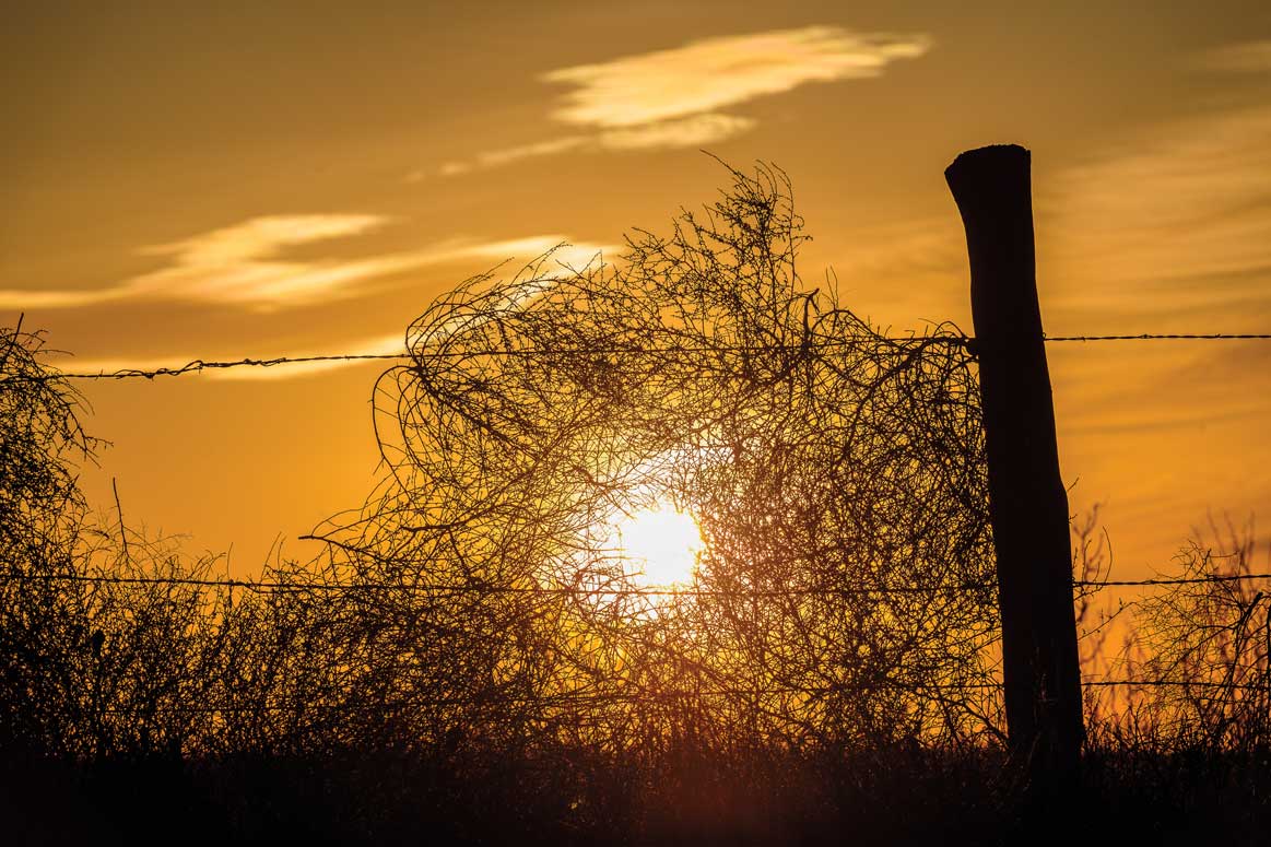
It’s about an hour along Interstate 30 and US 180 to Mineral Wells. There’s roadside construction for much of the drive, which makes it a little tough to tap into the feel-good nostalgia of it all. I welcome the eventual sight of rolling hills as I get closer to town and the scenic views as the construction ends and wide-open spaces begin. There’s no set time for me to be anywhere. I have no appointments or scheduled activities. I cruise past bait and tackle shops and feed stores, some that look so old they might have been open when I traversed these roads with Pampaw.
Today, it’s hard for most of us to imagine going on a Sunday drive for a reason other than soccer practice or to pick up groceries. In an era when self-driving Waymo cars coast around cities, the novelty of cruising highways and backroads has perhaps lost its allure.Gas prices don’t help, and neither do increased traffic and the sight of 18-wheelers barreling down a two-lane road. The first gas-powered car arrived in Texas in 1899, so we’ve had over a century to grow bored of just … driving. Especially if there’s no set destination, no clear goal. But as I casually steer along the routes I once took with Pampaw, I’m not bored at all. With nowhere to be, I’m free to head in any direction—and the road opens up.
LUCKENBACH TO ROUND ROCK
Shoot the Breeze
The wind mixes with memories on a Hill Country motorcycle trip
By Addie Broyles
It’s November, and I’m perched on the back of my uncle Tom’s motorcycle just west of Austin, noticing signs that the season is changing. Pecan trees drop nuts that will soon be served in pies and flameleaf sumac sprinkle vibrant yellow, orange, and red amid the never-ending forests of Ashe juniper.
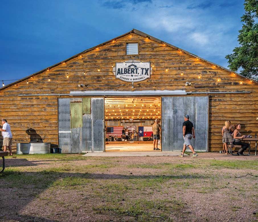
We’re heading to Luckenbach and Albert, two former ghost towns near Fredericksburg that are as steeped in history as our relationship.
The first time I went to Luckenbach in 2005, I didn’t know a kolache from a klobasnek. I had moved to Texas to be part of the laid-back, creative community in Austin that had also drawn my dad’s landscaper brother to relocate here in the 1980s. After work, he liked to ride his ’93 Harley Heritage Softail Classic to one of the honky-tonk bars in town, like Broken Spoke or Ginny’s Little Longhorn Saloon.
I lived with Tom during that first summer when I was 22 and trying to decide if Austin was a place I might make a home for myself. When my parents came to visit from Missouri, he took us to Luckenbach to see the town made famous by Willie Nelson’s Fourth of July Picnics in the 1990s.
Back then, my dad was a healthy, 50-something hiker and music lover who appreciated Flaco Jiménez as much as the Doobie Brothers. He was the kind of guy who would rent a motorcycle and ride alongside Tom, who knew which backroads would lead to a steel guitar and a cold Lone Star.
With tens of thousands of Hill Country miles under his belt, Tom, even then, would have balked at the popularity of Luckenbach. But his brother wanted to see the place made famous by Waylon Jennings and Willie. So, we headed west, immersed in a type of music we couldn’t quite dance to and drinking a beer that I didn’t like (yet). That night, I bought my first shiny red pair of cowboy boots at a secondhand shop.
The Drive
Time
3 hours, 36 minutes
Distance
218 miles

After I started a family, Tom and I stopped riding and two-stepping together. I got divorced. He retired and sold his place. Politics got in the way. We didn’t speak for years. But when my dad was diagnosed with prostate cancer in 2017, things changed. Doctors gave him two to five years to live; he made it 18 months.
After my dad was gone, Tom and I made an effort to get together. We could sit around the fire of grief and talk about what we loved about each other, not what we didn’t understand. To mark two decades since our first trip, we hop on his bike and bring along his bride-to-be, Sandy, a nurse who learned how to ride a motorcycle after she and Tom started dating.
We load up at dawn at their northwest Austin house for a day rolling down memory lane. We take the backroad to Marble Falls, following Anderson Mill Road all the way to Ranch-to-Market Road 1431 just west of Cedar Park. Then, we make our way through Lago Vista and Jonestown, across a new bridge built after the devastating floods last summer. We putter along the smooth, winding roads on the north side of Lake Travis with Sandy following behind us on her own bike. As a passenger, I don’t have to do anything except enjoy the sweeping views and memories that start to creep in.
Cozied up at a booth in Blue Bonnet Cafe in Marble Falls, we peel off some layers and talk about Tom and Sandy’s upcoming underwater wedding in Mexico. I tell them my family is thinking about moving to Spain. We are both living life on our own terms. My dad would be proud. After pancakes, we bundle up and hit US 281 all the way to Blanco, where we take River Road west to skirt around the wine trail. On the bike, 30 miles per hour feels like 60.
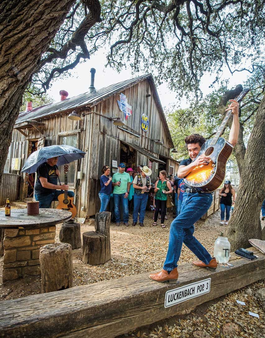
Arriving in Luckenbach before noon on a Sunday, I know what to expect: a band shuffling through a carousel of familiar country hits and a cold beverage. I’m glad to see the shop where I bought my boots, but they only sell hats now. Although Luckenbach peddles nostalgia, there’s plenty of new to be found: a fancy retail store, climate-controlled bathrooms, White Claws in the cooler.
We don’t stay long because we want to take a 15-minute jaunt to Albert, which is more Tom’s style these days. Under a massive oak tree that was supposedly Lyndon B. Johnson’s playground back in his youth, we sit at the bar and listen to a man sing about honky- tonkin’ all night long.
Tom points to a sea of photos hanging on the wall and singles out his own face, a picture taken about 20 years ago. It’s a snapshot from yonder past, a unit of time just beyond measure. Close enough to see the lines carved by time, but far enough away to blur the details of why.
It’s 3 p.m. when we head back to Austin. As we stand in front of the bikes to take one last picture together, I want to remember not only this day but all the days before. Even the cloudy, cold ones I wouldn’t have picked. They are part of the changing seasons, too.
DENVER CITY TO BLEDSOE
Border Line
Driving the West Texas road to nowhere
By John T. Davis
With all due respect to Robert Earl Keen’s famous song “The Road Goes on Forever,” –the road does not go on forever and the party emphatically does end.
At least, that’s the case with Texas Farm-to-Market Road 769, a ruler-straight 41.5-mile ribbon of two-lane blacktop that begins about 13 miles west of the oilfield town of Denver City. The road bisects a piece of far West Texas that is the domain of cotton farmers, ranchers, oil patch workers, and, well, not a whole lot else. There are no landmarks of note along the entire stretch except the tiny ghost town of Bronco at the intersection of 769 and US 380. The road begins at a random spot outside of Denver City and concludes at a nondescript junction with State Highway 125. It’s the road to nowhere.
It has one one distinction: 769 precisely follows the state line between Texas and New Mexico. Heading north, Central Standard Time is on your right, Mountain Time on your left. On the one hand, the Great Plains, on the other the Llano Estacado. Chicken-fried steak versus red chile and blue corn enchiladas. Cowboys and conquistadores. The asphalt divide lends itself to the imagination. Lacking distractions, it becomes a road of contemplation.
Ever since discovering this little stretch while driving from Austin to New Mexico, I’ve always wanted to take a closer look. So, on an unseasonably mild fall day, my wife and I find ourselves lazily making our way north on 769 to see what is to be seen.
We drive through a panorama of two colors: the autumn-gold disc of the High Plains shortgrass prairie and the turquoise dome of the sky. The road itself seems random, almost like an imaginative object applied onto the landscape. To me, it is like a giant art installation from the mind of, say, Donald Judd or Walter De Maria. KBIM-FM radio, the “Country Giant,” out of Roswell, provides our soundtrack.
To the locals, of course, it’s just a conduit between cotton fields and fracking sites. It is high cotton season, and where the fields have not been harvested, the crop looks like cake frosting. After a while, cultivation peters out and we are left with the llano as it must once have appeared. We wouldn’t have been surprised to see bison crossing our path.
The road forms the easternmost edge of Yoakam and Cochran counties. Except for the discovery of oil and the advent of agriculture and ranching, history seems to have touched it very lightly, except in Cochran County, where the road borders what once was the Yellow House division of the vast and celebrated XIT Ranch.
The Drive
Time
1 hour, 6 minutes
Distance
48 miles

After less than two hours, we reach the northern terminus of 769 and turn around. We could veer right and venture up onto the Great Plains and all the way to Canada or turn left and set our sights on Santa Fe and the Rocky Mountains, but those are journeys for another day. Instead, we head back south, enjoying our little sojourn on the road to nowhere.
On the return, my thoughts turn to West Texas singer and artist Terry Allen, whose music is an ideal soundtrack for this austere landscape. I recall something Allen once said on the subject of driving for its own sake: “Nobody with a fast car, a good radio, and a straight road should ever need a psychiatrist.”
CHILDRESS TO PERRYTON
At Long Last
A longtime Texan explores a new section of road
By Joe Nick Patoski
Over the years, I’ve traveled the “longest highway in Texas” in fits and spurts, frequently picking up the Menard to Ballinger portion on drives from Central Texas to Lubbock and New Mexico. But the last 150 miles of US 83 skirting the eastern Panhandle remained a mystery. You have to be headed to Kansas or the Nebraska Sandhills to use that part. I’ve long wanted to drive this new-to-me stretch.
Extending 906 miles from Brownsville to the Oklahoma line at the top of the Panhandle, US 83 roughly traces the 100th meridian through America’s midsection. Almost half of the 1,885-mile route runs through the rural, western-facing part of Texas, crossing through Laredo and Abilene as well as Brownsville. Maybe it’s the romantic in me, but US 83, not Route 66, feels like the real Mother Road.
Shamrock is the first of three major towns along this part of US 83. The mural by Tower Plaza beneath the highest water tower in Texas identifies Shamrock as the Crossroads of America, sitting at the intersection of Interstate 40 and old Route 66. The historic U-Drop Inn and adjacent Conoco station, now the visitor center, is a lovingly restored Route 66 landmark. But it’s not the road’s only architectural gem. The circa 1929 Magnolia gas station with sandstone bricks and preserved pumps—along the original Route 66—is a block east of US 83.
Leaving Shamrock, there are few billboards, a handful of traffic lights, and minimal trucks. I feel like I’m gaining elevation passing through foothills that would eventually lead to the Rockies. The roadside opens up into expansive views of rolling prairie, fences, oil tanks, and scatterings of cattle.
The world beyond the pavement seems closer, more intimate than it does from the interstate. The rhythm of passing through small towns like Twitty and Wheeler becomes an integral part of the drive. The speed limit drops from 75 to 70 to 55 to 45 to 40, then 35 and 30, before ticking back up again on the open road.
The Drive
Time
2 hours, 28 minutes
Distance
158 miles

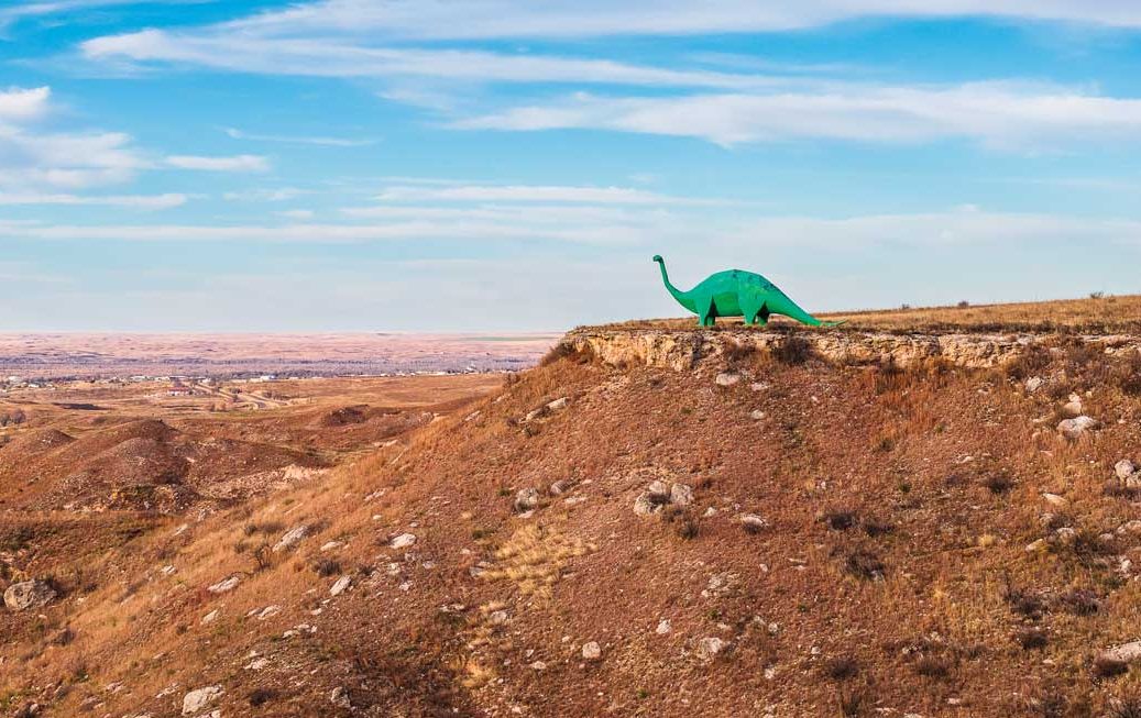
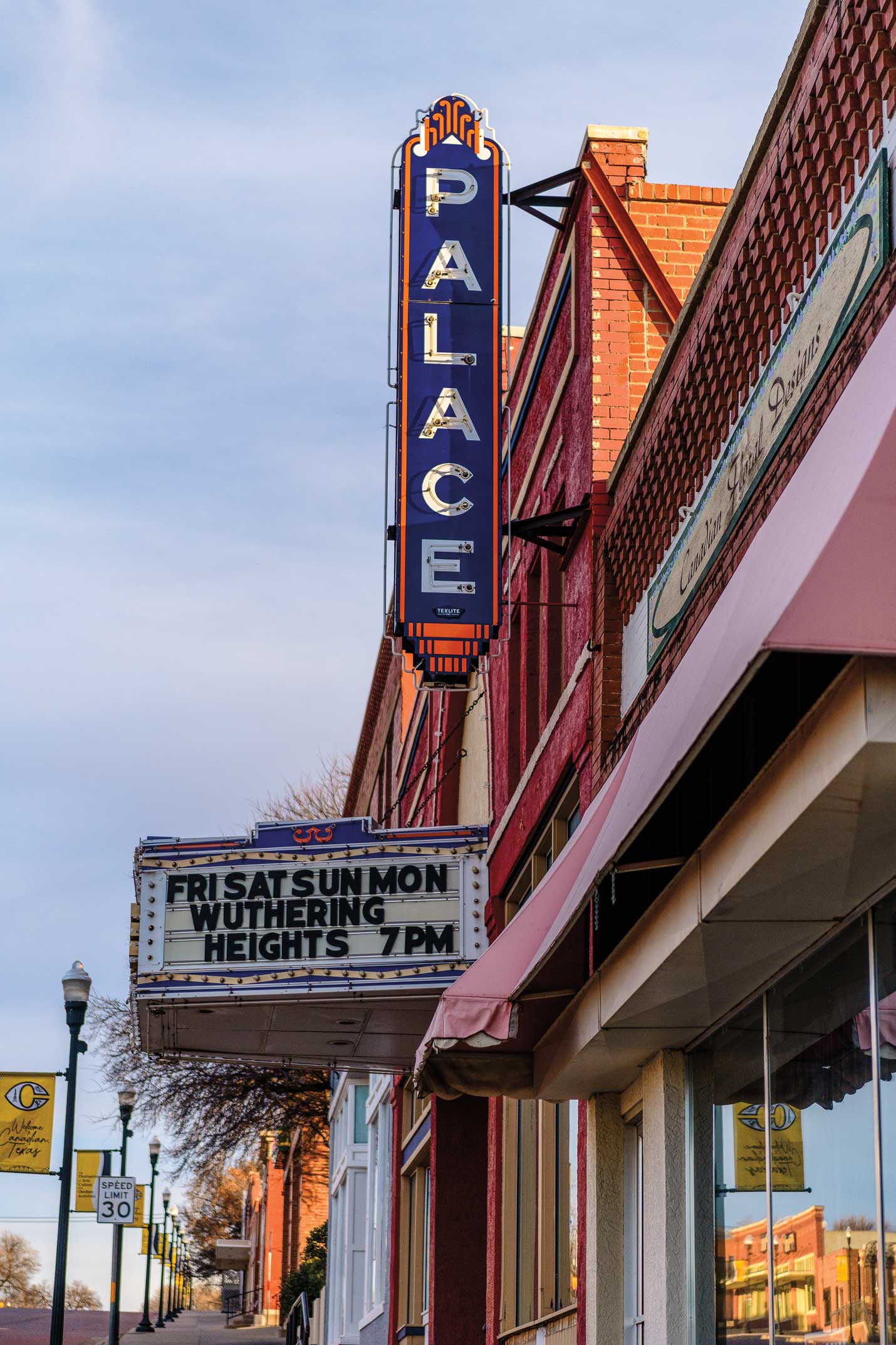
I pass remnants of the Smokehouse Creek fire, the largest wildfire in Texas history, which scorched more than 1,655 square miles in 2024, and Aud, artist Gene Cockrell’s giant green steel-and-concrete brontosaurus standing sentinel on a bluff, before arriving in Canadian, my favorite small town in Texas. The restored Cattle Exchange building, the River Valley Pioneer Museum, and the Palace Theatre gussy up the wide, two-block red brick Main Street downtown. The Citadelle Art Museum, which punches well above its weight, is five blocks up the hill. In the late afternoon, scores of joggers and walkers fill the hike-and-bike trail along the old Canadian River Wagon Bridge.
From Canadian, US 83 veers northwest through undulating grasslands reminiscent of the Nebraska Sandhills, dotted with working windmills, oil storage tanks, and pipeline compressor stations. Perryton, the last Texas town on US 83, looks like Norman Rockwell Americana, but my morning cup of coffee at Dulce y Feroz comes accompanied by an authentic red chile burrito.
I spot a cheese shop along the highway, so I pull into Watonga Cheese Factory and pick up some of the house specialty smoked longhorn cheddar, aka “The Horn.” North of town, past the grain elevator—the tallest structure in Perryton—the Museum of the Plains provides a top-shelf glimpse of the region’s past with wagons, tepees, an airplane, and a section dedicated to Hank the Cowdog, the cartoon canine created by native son John R. Erickson. There are also more than a dozen restored tractors, including the big machines that in 1919 physically moved buildings from the town of Ochiltree, 6 miles south, to where the railroad laid tracks—present-day Perryton.
US 83 ends its run through Texas with a sigh, 7 miles north of Perryton, amid a jumble of telephone poles and power lines, distinguished by an abandoned service station on the west side and the ruins of a bar across the way. Wind turbines rise on the other side of the borderline, giant blades turning purposefully under low clouds bathed in the morning light, with pumpjacks on the ground faintly visible in the distance. A humble sign with a star and the words “Welcome To Oklahoma” appears ahead. Everything else is open land. The heartland looks pretty good in its desolation and remoteness.
I feel the tug to keep going, but I turn around instead, satisfied. So much of this route felt like going back to when ranching and agriculture defined Texas’ economy, to when all the storefronts in the small downtowns with red brick streets were occupied, to that time when long-distance drives like this were almost always a pleasure.
ROMA TO SOUTH PADRE ISLAND
Paradise Found
Explore the history of the Rio Grande Valley
By Danielle Lopez
Despite being born and raised in the Rio Grande Valley, I knew very little about the four-county region along the southern border when I lived there from 1994 to 2012. It seemed vast, old, sleepy, and, quite frankly, empty. But as time away has made the heart grow fonder, I’ve become addicted to getting to know every part of the place.
On a weekend in December, I decide to drive the entire length of the RGV in the span of two days. The stretch from the Valley’s westernmost town, Roma, to its most eastward, South Padre Island, is roughly 130 miles along US 83 and Park Road 100. The path takes me through 16 towns and several more unincorporated areas that run parallel to the main highway, a remnant of the way the area’s current iteration was formed around the Rio Grande and St. Louis, Brownsville and Mexico railways in the early 20th century. While the Valley today is full of new shops, restaurants, and other means of entertainment, I intend for my drive to be a trip back in time.
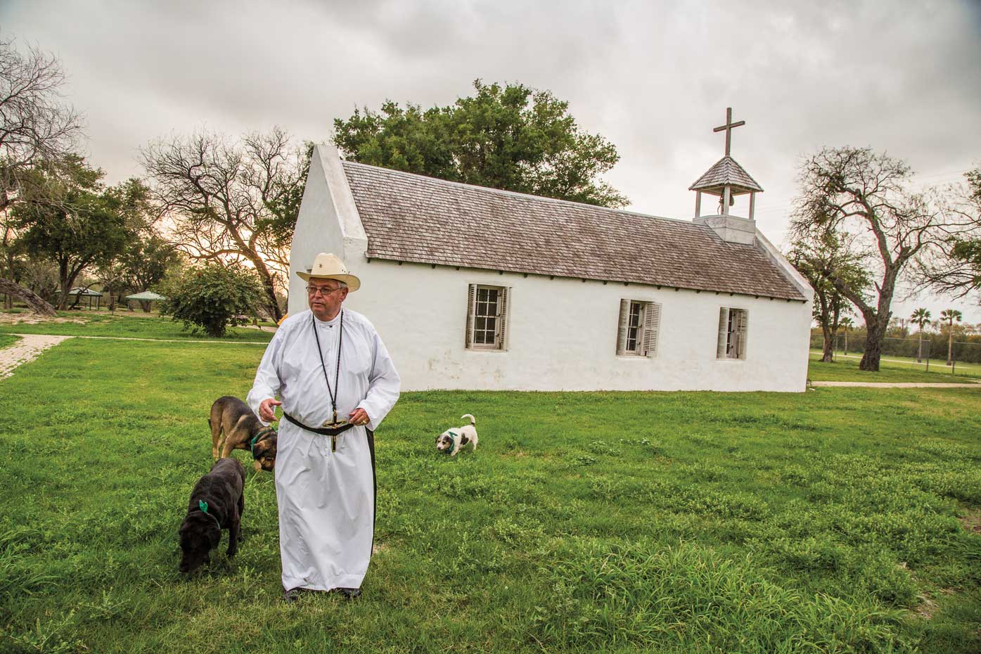
Sunday morning at sunrise, I take off from my hometown of McAllen and make my first stop at the La Lomita Chapel in Mission. As the city’s namesake, this little white adobe structure originally built in 1865 is tucked away on the border. It was once used by priests who would travel long distances to minister to isolated Catholics working on ranches along the Rio Grande. Though no one’s here, candles are lit, and the space is tranquil. Before leaving, I write something in the little notebook on a table filled with prayers from dozens of recent visitors, some who’ve traveled across Texas and from states like California and Iowa.
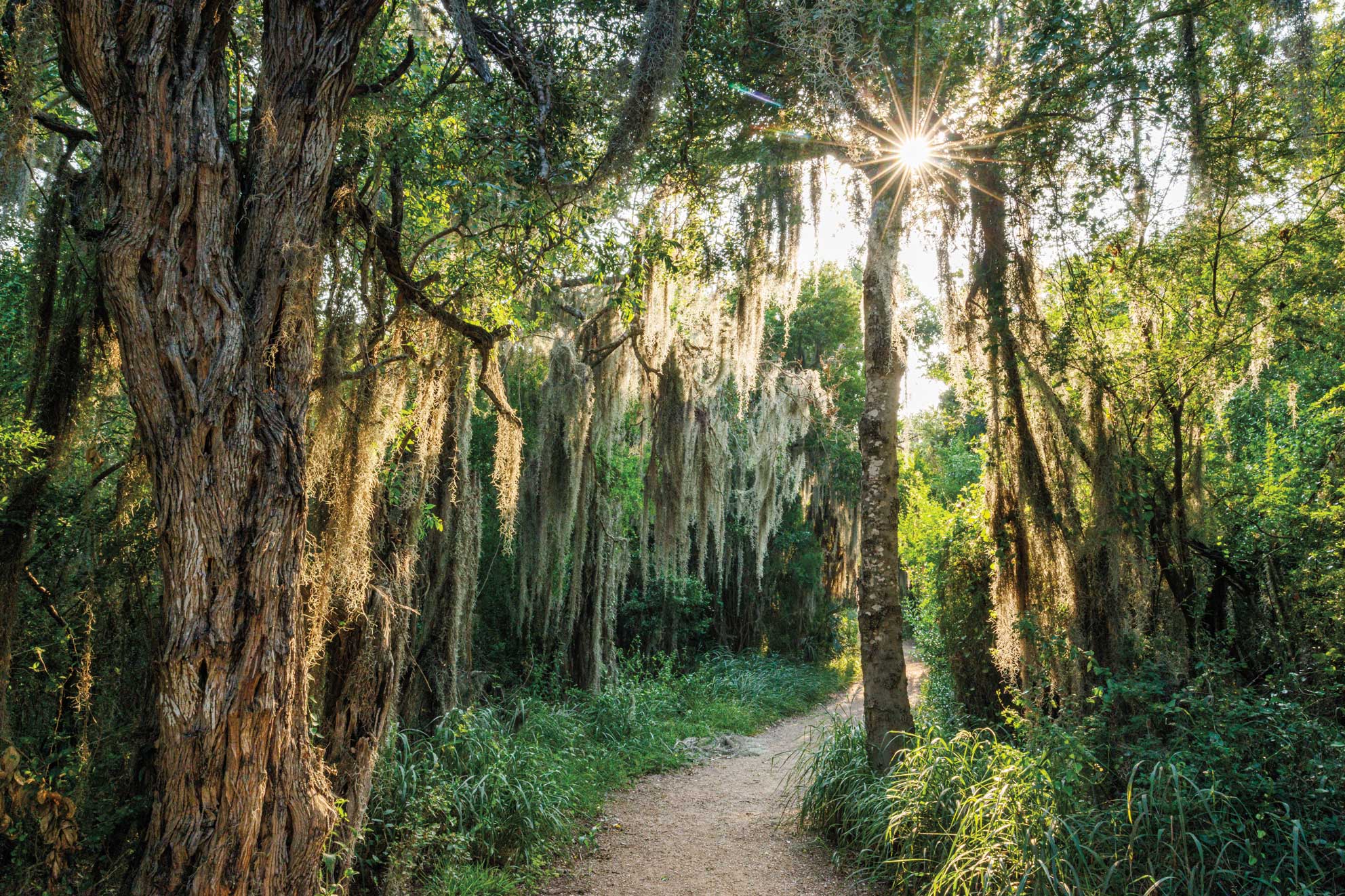
People from all over the country come to the RGV this time of year. Winter Texans come to escape the colder northern states, and avian enthusiasts—myself included—come for the region’s spectacular birding season. A few minutes later, I stroll into Bentsen-Rio Grande Valley State Park in Mission, located just down the road from the National Butterfly Center. Bentsen is one of four state parks serving the RGV and one of nine World Birding Center sites. I’ve arrived just after feeding time, and the park is alive with the flitter of green jays, cardinals, orioles, turkeys, chachalacas, herons, and more. The park, opened in 1962, preserves some of the last examples of trees native to the Rio Grande, including the Montezuma bald cypress, sabal palm, and Texas wild olive.
The Drive
Time
1 hour, 6 minutes
Distance
48 miles

Back on the road, the eastern end of the RGV gives a glimpse into what the area looked like throughout the 20th century. Stripped-down farmland surrounds the highway as the cities pass by quickly: Palmview, La Joya, Sullivan City. I hit Rio Grande City, the county seat of Starr County. The town of roughly 15,000 is home to Fort Ringgold, the southernmost installation of the western tier of forts constructed after the Mexican-American War that operated from 1848 to 1944. Today, visitors can tour the site’s surviving barracks, hospital, and armory.
When I finally hit Roma, I head straight for the historic town plaza, which is made up of an impressively preserved array of 35 pre-1900 Spanish Colonial and borderland-style buildings. Neighboring the Mexican city of Miguel Alemán, the plaza looks much like it would have in the late 19th century, only now there’s a World Birding Center and a
chic agave distillery, Ancestral Craft Spirits.
Roma marks the end of my westward journey, so I head back the opposite direction. About an hour into the drive, I approach the city of Alamo and take a detour south toward the Santa Ana National Wildlife Refuge. I walk the mile to its iconic skybridge that overlooks one of the last preserved native subtropical thorn forests. “This is the closest view of what the Valley looked like before development,” a sign reads. I walk deeper into the refuge and come upon an overlook that peers onto the Rio Grande. A lone bench on the edge of the small cliff invites visitors to gaze across the water into Mexico. I sit and marvel at this region’s history, its nature, and its proximity to another country—just a few of the things that make the RGV worth exploring.
A little over an hour later, I stop at the shops in Port Isabel, take stock of its titular lighthouse, and make my way over the Queen Isabella Causeway, the only bridge to South Padre Island—my favorite place in the state. I pick a beach access, pull out my chair, plop it in the sand, and watch the sun set. I’ve arrived in paradise.