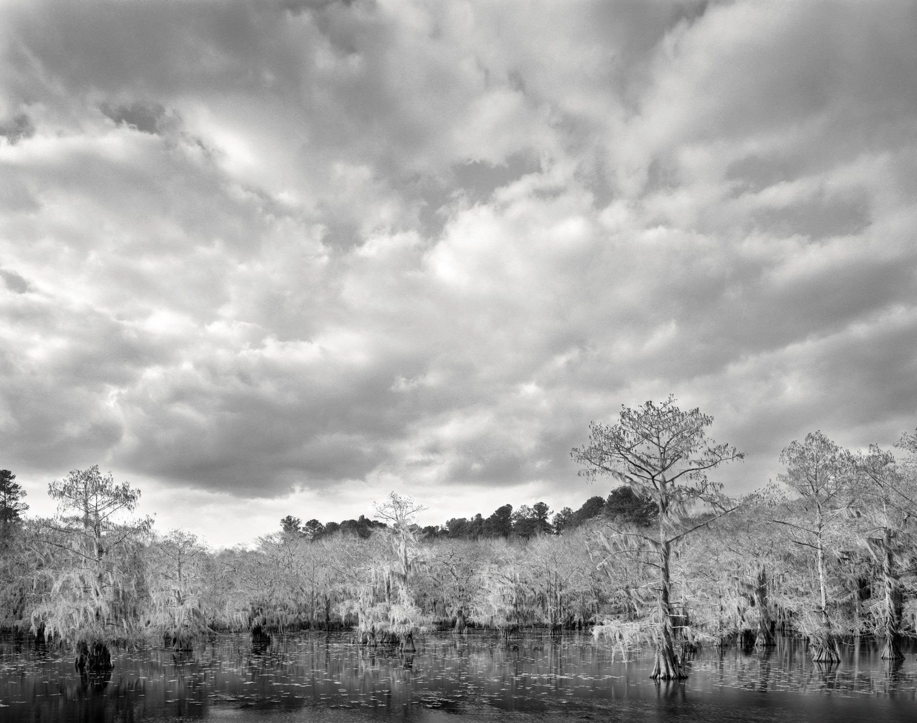
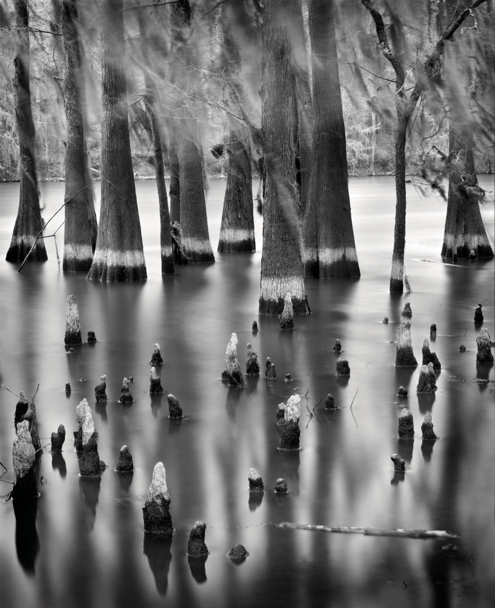
But these wetlands—40 square miles in northeast Texas and in bordering Louisiana—are even more complicated than that. They are pretty, no doubt. They are also frightening, weird, and alien. Primordial, in an unsettling way. To someone who is accustomed to open and easily navigated water, they are incomprehensible.
The organizing principle of the lake and the bayou is, in fact, a mystery, and this notion extends far beyond the swamp’s physical attributes. The most puzzling part of Caddo’s history is why the lake is there at all. It has survived for more than 200 years in spite of many human and biological interventions that should have killed it. The catalogue is extraordinary: It has been polluted, drilled, dynamited, dammed, alternately drained and flooded, commercially harvested, and attacked by weeds.
Yet somehow it has persisted and is still one of the great jewels among North American wetlands. The tale of its survival is one of the strangest and most interesting chapters in Texas history. “It is a much-abused lake,” says Thad Sitton, author of Caddo: Visions of a Southern Cypress Lake. “You combine that with the idea that a big shallow lake is by nature ephemeral—it just naturally fills in. So there has been this almost constant threat from one direction or another.”
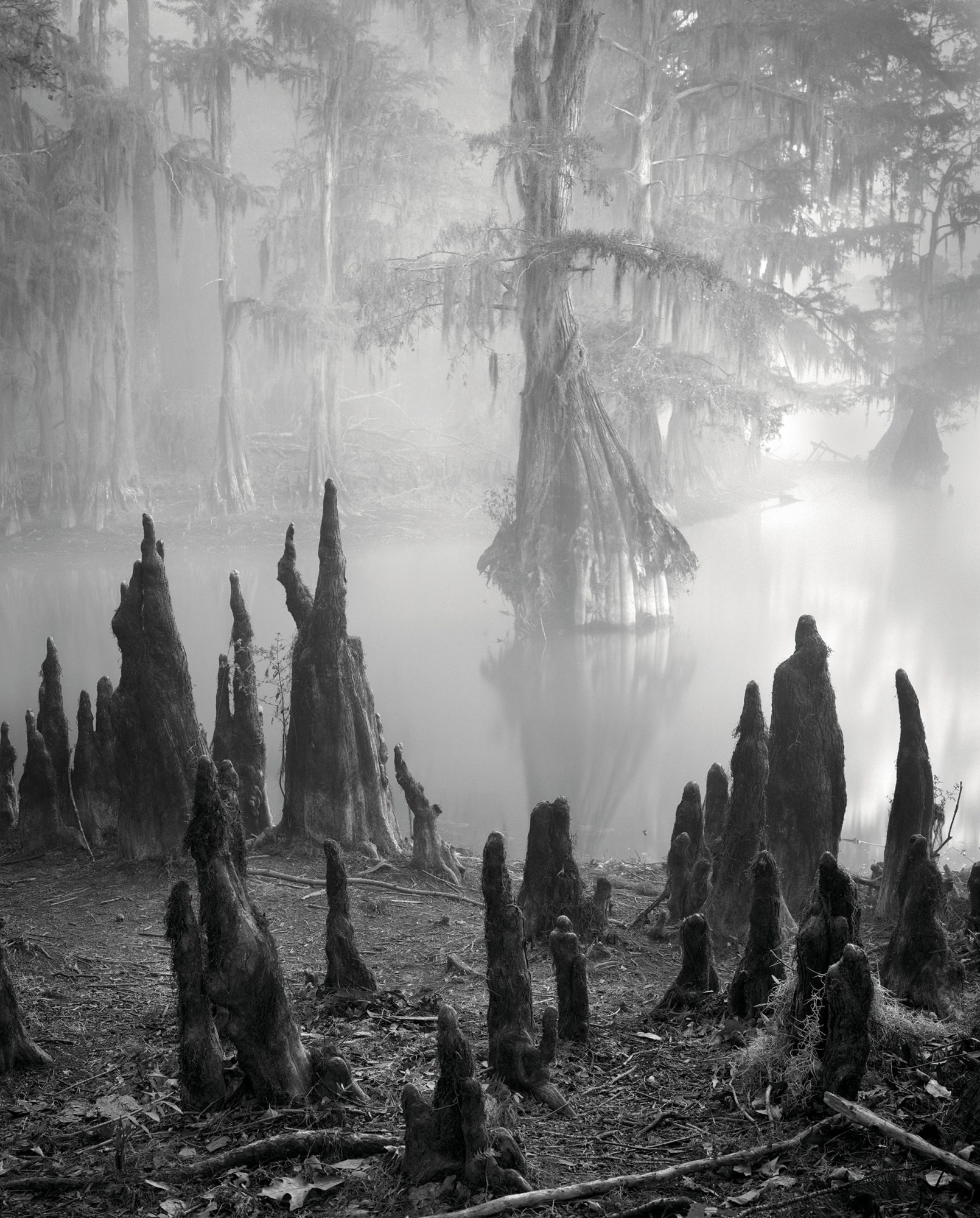
We were following what the locals call “boat roads,” painted posts erected to prevent boaters from getting lost, because getting lost out here is the last thing you want to do. One wrong turn into its tunnel-like, tree-crowded channels and you will spend a night, as locals say, in the “Caddo Motel,” with alligator gar, alligator snapping turtles, actual alligators, and about 60 other species of reptile.
The most puzzling part of Caddo’s history is why it’s there at all. It has survived for 200 years in spite of many interventions that should have killed it.
And then—just like that—we lost our bearings. The boat markers disappeared. The bald cypress trees closed ranks behind us. The sun vanished, too, turning the gumbo-colored water instantly to black. We were adrift in a directionless, dead-end bayou, paddling ever more anxiously back and forth in search of any sign that might lead us out of there. This is the part in the movie where the kayakers make a catastrophically wrong decision. To our relief, we finally glimpsed a strip of red paint in the boggy distance. The place was lovely, all right. It also demanded our full attention.
Prior to that, the Red River, which forms part of Texas’ northern boundary and bends down into Louisiana before joining the Mississippi, was the site of a centuries-old logjam more than 100 miles long. History knows it as the Great Raft. It was created by flooding that stripped cottonwoods and other trees from the banks and washed them downstream, eventually forming a floating expanse of wood that people could walk and even travel on. The Great Raft moved upstream at one mile per year and constituted a barrier to navigation from downstream places like New Orleans. This protected the Caddoan tribes from white settlement.
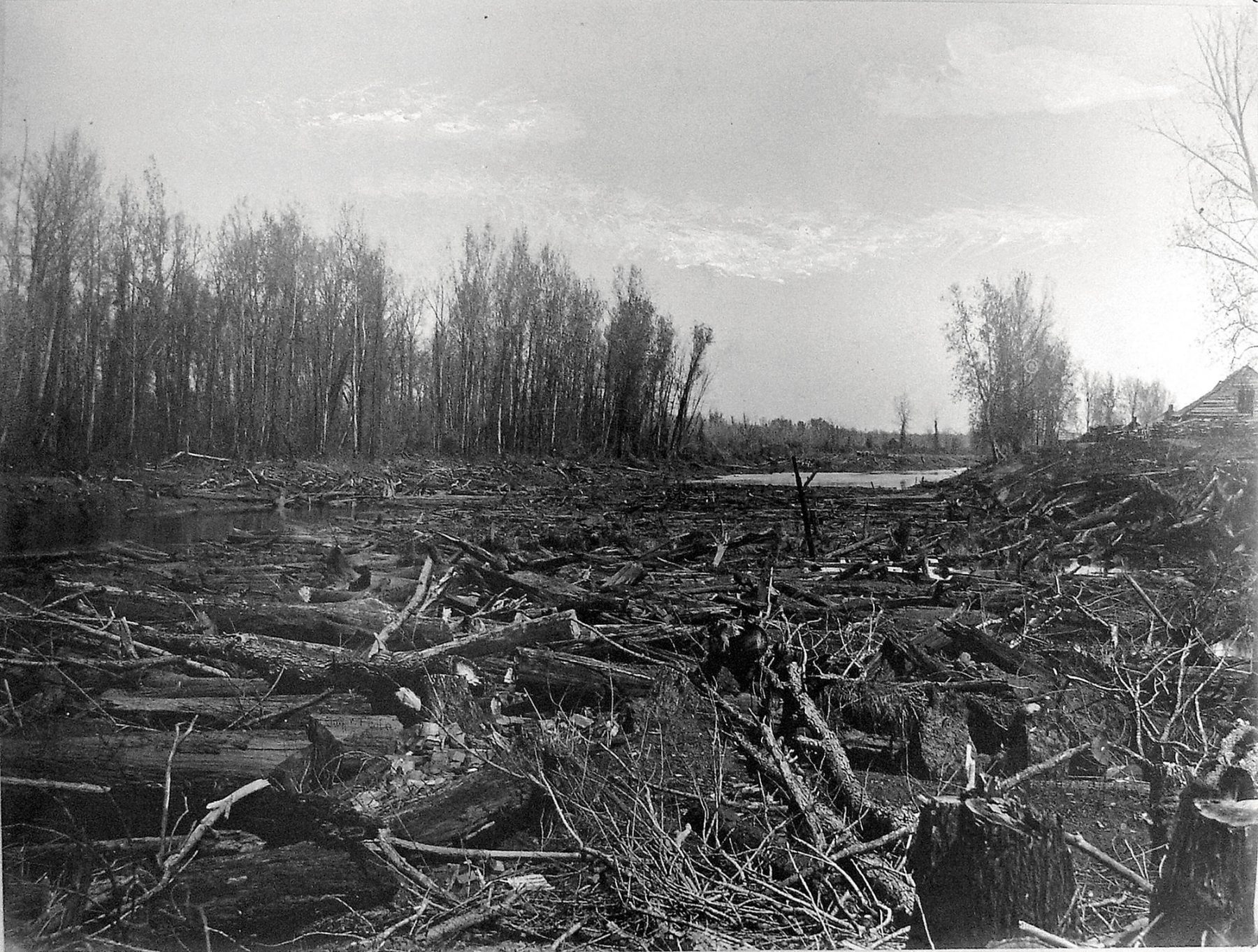
The Great Raft, seen here in the 1870s, was an epic logjam dating back centuries and stretching more than 100 miles.
As the Great Raft built north of modern-day Shreveport at the close of the 18th century, the Red River finally burst its banks, sending a massive cascade of water both east and west. Native American legends describe the roaring sound of the onrushing water. To the west—in Texas—the surge flooded the boggy lowlands and a sluggish west-east waterway known as Big Cypress Bayou. In a matter of a day or perhaps just a few hours, this created a chain of lakes, including Caddo.
This great natural event killed most of the trees, drowned any number of unsuspecting Native Americans, and removed the Caddoans’ protective barrier. By the 1840s, this in turn led to the opening of an enormous section of northeastern Texas to commerce on the river.
The change allowed the passage of low-slung, shallow-draft, side-wheeled steamships from Shreveport traveling northward on the Red River, then westward across the newly created lakes, and up the now-navigable Big Cypress Bayou. This transformed the tiny town of Jefferson, about 15 miles east of Caddo Lake, into a major cotton depot and one of Texas’ first boomtowns. By 1872, fueled by the trade of hundreds of steamboats over three decades, Jefferson had become the sixth largest city in Texas, population 7,500, with New Orleans-style architecture, gas streetlights, slaughterhouses, a cannery, shoe and garment factories, and Texas’ first ice factory.
Then came the bust. In 1873, the U.S. Army Corps of Engineers used generous amounts of nitroglycerin and advanced steam-powered machinery to destroy the last of the Great Raft. This eliminated one problem but introduced another. The river no longer took its big western detour, resulting in a major drop in the levels of the lakes and bayou. This made upstream navigation to Jefferson much more difficult. In combination with the rise of the railroads, which favored Marshall 15 miles to the south, this change ended most of Jefferson’s cotton trade and marked the abrupt decline of the city as a commercial center.
The government was not done there. Apparently unaware that commercial navigation on Caddo Lake and Big Cypress Bayou was as good as over, the Corps of Engineers tried to improve steamship routes by blasting and dredging miles of new channels. This involved blowing up countless fish. So many were killed that a cottage industry arose out of gathering up dynamited fish and selling them.
A few years later the Corps of Engineers was back at it again. This time, they decided to close off 43 remaining “distributaries” of the Red River—remnants of the old flood that continued to feed Caddo Lake. The effect was catastrophic. Lake levels dropped dramatically. The last of the steam packets that still wound their way to Jefferson gave up. The only water coming into Caddo Lake now came from Big Cypress Bayou, which was not enough to sustain more than a shallow swamp and bog.
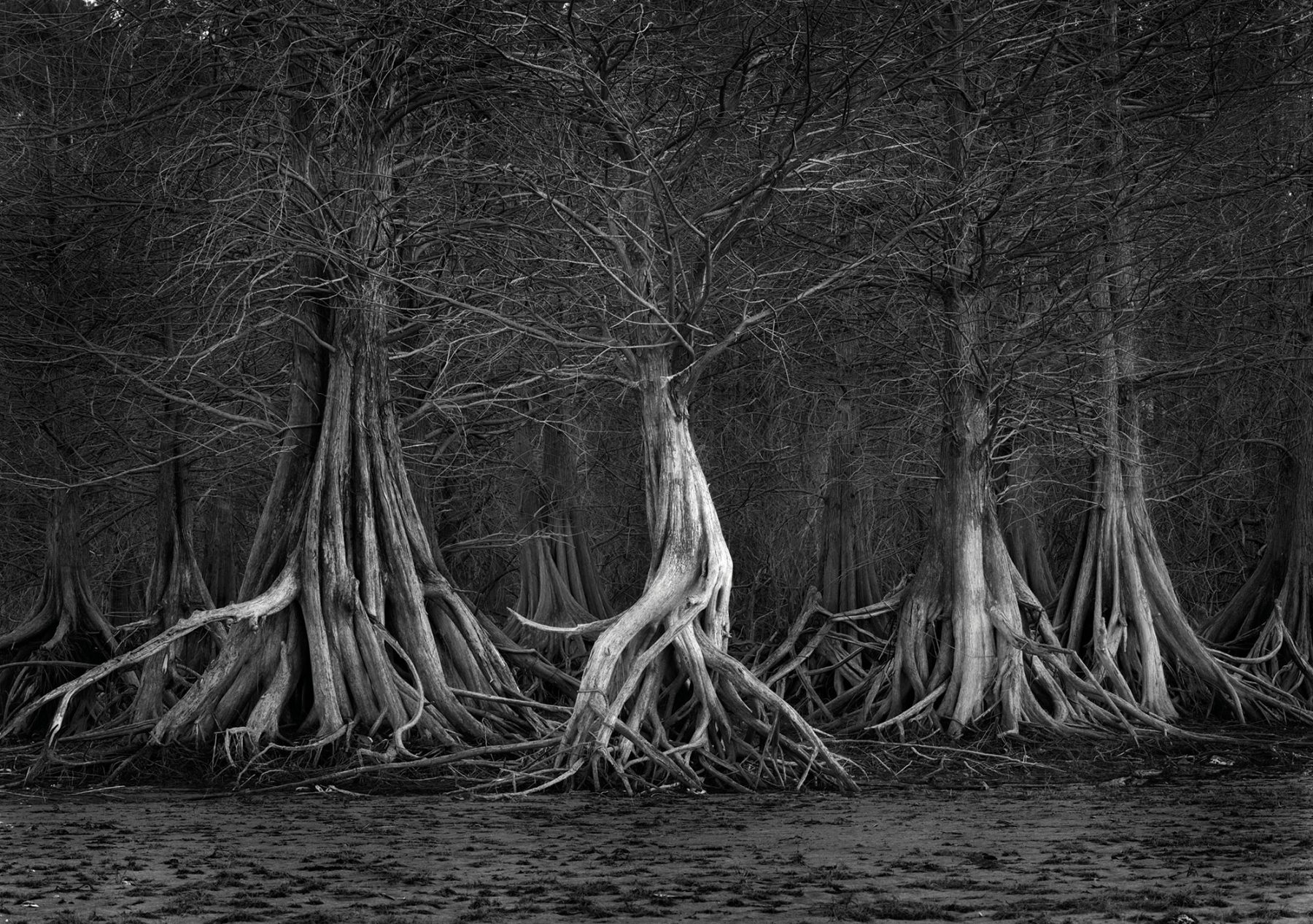
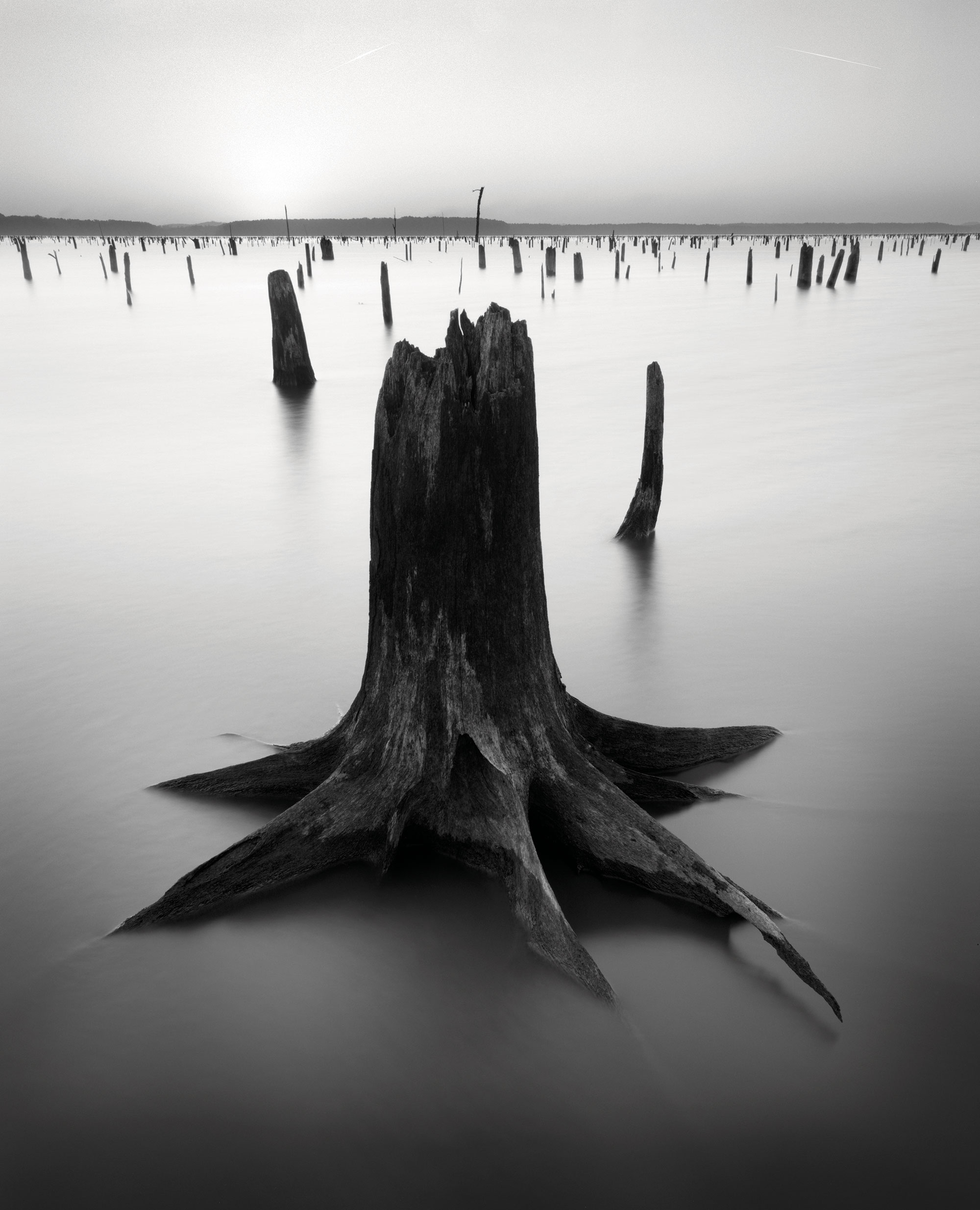
By this point, it is fair to say that the lake, more than 100 years after forming, was a miserable, ugly, polluted, unnavigable bog pocked by tree stumps and oil rigs. The only good news was that the 20 year low-water period had allowed a new generation of bald cypress trees to germinate and take root. Though travel brochures boast of “400-year-old bald cypress trees,” in fact almost every tree you see in the lake dates from the early 20th century. This is another of the lake’s miracles.
A moment of reprieve did, however, come in 1914, when Gulf Oil, whose drilling had been made more difficult by the low lake levels, built a small dam on the east end of Caddo. This refilled the lake and transformed it from a natural lake (there is a myth that Caddo Lake is Texas’ only natural lake, when in fact there are scores of smaller natural lakes) to a reservoir. Thus, the waters rose again.
“When I was researching my book, I heard all these stories—ducks that blackened the sky, schools of feeding bass in the bayou that would turn the water to froth,” Sitton says. “Alligator gar, once the lake’s signature fish, were there in great numbers. There was a huge fishing industry on Caddo that is just gone with the wind. [This] place, as beautiful as it is, is so around the curve from what it once was.”
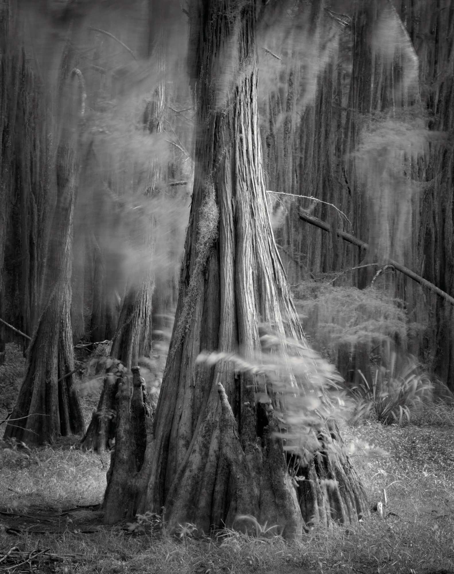
We saw fish everywhere. We witnessed otters, herons, and egrets. Dogwoods exploded in nearby glades. I would say I was in a swamp that dated from the Dark Ages.
It seems hard to believe, but the destruction to Caddo wasn’t yet complete, though what happened next might be termed a side effect of war. In 1941, a fast-rising congressman named Lyndon Baines Johnson helped secure more than 8,000 acres bordering the lake to construct an ammunition factory. The owner of that land happened to be T.J. Taylor, a local entrepreneur in the town of Karnack and the father of Johnson’s wife, Lady Bird. The Longhorn Army Ammunition Plant produced 415 million pounds of TNT in World War II and was later used to destroy nuclear missiles, as part of a U.S.-Soviet Union treaty. Environmental regulation of the plant was lax for most of the 55 years of its operation, from 1942 to 1997. As a result, hazardous chemicals such as trichloroethylene (industrial solvent) and perchlorate (rocket-fuel additive) were routinely dumped into uninsulated pits and ponds near Caddo Lake. This overflowed into creeks, which drained into the lake. The extent of the pollution became clear in 1990 when the EPA designated the ammunition plant a “superfund” site, a distinction reserved for the country’s worst toxic messes.
Riding to the rescue was Don Henley, front man for the rock band the Eagles, who grew up in nearby Linden. Henley and the nonprofit he formed in 1992, Caddo Lake Institute, fought the project for years, and eventually won. In 2000, they managed to help turn the Longhorn Ammunition Plant land into the Caddo Lake National Wildlife Refuge.
“Some folks wanted to turn it into an industrial site,” Henley says. “We wanted to put it back into the ecosystem of the lake. The good part of it is that because it was government land, a large part of it remained untouched, including a lot of bottomland hardwoods, some of which date to the Civil War. The bad part is that some of that property is a toxic superfund site, and though it’s a relatively small portion, and the surface has been cleaned, the groundwater will not be detoxed for another hundred years.”
An equally significant victory was a recent agreement to release more water from the Lake O’ the Pines. This has already had a significant impact on the lake. Not only will the volume of water increase, but the releases are also meant to mimic the floods that occurred before the dam was built. “We are trying to restore some semblance of nature,” says Robert Speight, a local activist and president of the Caddo Biocontrol Alliance. “One of the success stories from that is the reintroduction of the paddlefish.” This exotic-looking and deeply threatened species—the continent’s oldest—is 300 million years old, which is older than the dinosaurs.
But Carter’s Chute also offers a working illustration of the latest, and perhaps most dire, threat the lake has ever faced. In recent years, giant salvinia has often blanketed this immaculate stretch of water. Locals call it, only half-jokingly, “the fern of doom.” The weed, which came to the U.S. from South America as an aquarium ornament and showed up at Caddo in 2006, forms a dense green mat that grows so thick that canoers often can’t paddle through it, and it eventually blocks the passage of all light into the lake. Salvinia can double in size every two to four days and can cover an astounding 40 square miles in three months. In recent years, salvinia has covered as much as 60 percent of the Texas side of Caddo Lake. In the summer of 2013, Carter’s Chute was in the middle of a 7-mile-long mat of salvinia so thick you could not see water.
“It has changed a lot of things on the lake,” says John Winn, a guide who has lived there since the 1970s. “Like the habits of ducks. They have no way to get in there. They don’t see open water. When the salvinia is bad, it affects not only other plants but smaller fish species—minnows, chubs, shiners—and that affects the bigger fish.”
Early attempts to control the invasive weed, including mechanical harvesting and building a 2-mile fence to contain the plant’s spread, had little effect. The latest approaches involve spraying herbicides and deploying a tiny black bug known as the salvinia weevil, which feeds on the salvinia and produces larvae that kill it. “The herbicides work pretty well,” says Laura Speight, a wildlife biologist with the Caddo Biocontrol Alliance. “The problem is that there are a lot of places on the Texas side of Caddo that you can’t get to with a spray boat.”
Alas, the weevils have proved to be an imperfect solution. The problem, Speight says, is the salvinia is more cold-tolerant than the weevil is, which means that the weevil populations don’t live through a cold winter. “This year for the first time we actually overwintered weevils outside of the greenhouses.”
Even if the poison and weevils kill the weed, there’s the biomass that falls to the bottom of the lake. Not only does it fill the lake in, but it catches silt and sediment that make the lake fill in even faster. The one thing that truly kills salvinia is Mother Nature. In 2019, Carter’s Chute was largely clear of the weed, thanks to a harsh winter in 2018.
“We are very hopeful for the future of the lake,” Don Henley says. “We aren’t going to give up and say, ‘Oh, the lake can’t be saved.'”
It is impossible to find anyone who knows anything around Caddo to say that the problem is under control, or close to it. “I wouldn’t go so far as to say we are winning the fight,” Robert Speight says. “I am optimistic that we will be able to keep some semblance of normalcy, which is not to say that it isn’t going to get bad in some places. But between the weevils and the spraying, if we can get Mother Nature to throw us a cold winter or flood, we will be able to tread water.”
In the meantime, and against all odds, the Caddo persists, as does the never-ending catalog of threats, which now include feral hogs, a bug called the emerald ash borer, sediment from the clear-cutting of forests, and aquatic plant invaders like hydrilla and crested floating heart. Henley, who continues to fund much of the fight to preserve the Caddo, is optimistic, though. “We are very hopeful for the future of the lake,” he says. “We aren’t going to give up and say, ‘Oh, the lake can’t be saved.’”