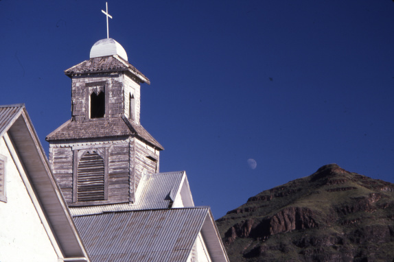
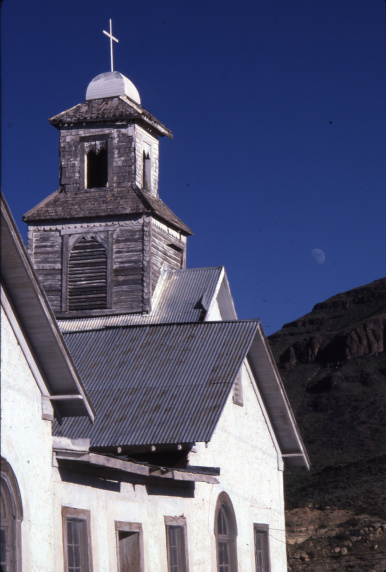
An abandoned church in Shafter. Photo by J. Griffis Smith
Remnants of once-bustling towns are scattered across Texas. With 511 ghost towns, Texas has the most out of any state, according to Geotab, a GPS hardware company. The company compiled a list of over 3,800 ghost towns, creating an interactive map that showcases the “Ghost Towns of America.”
Many ghost towns date to the 1800s, an era of industrialization and westward expansion. But each town has a unique story that contributed to its demise. Here are the stories of four of Texas’ lesser-known ghost towns.
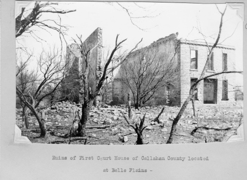
Ruins of the Callahan County Courthouse in the ghost town of Belle Plain
Belle Plain (Callahan County)
During the 1870s, Belle Plain was thought of as one of the most promising West Texas towns. “We do not know of a more pleasant or beautiful place or one with brighter prospects for a prosperous future than Belle Plain,” wrote Captain George W. Robson, a newspaper proprietor and editor from New York, in an 1879 edition of the Fort Griffin Echo.
Belle Plain was established in 1876, 40 minutes southeast of Abilene, and designated as the seat of Callahan County in 1877. At that time, the town had several stores and saloons, a jail, a hotel, and even a newspaper, the Callahan County Clarendon.
Belle Plain College was the pride of the town, as it was one of the first institutions of its kind in West Texas. In 1881—its first year—the college enrolled 22 students. By fall 1882, there were 85 students. While the college taught classical courses like philosophy, history, astronomy, and physics, the college’s reputation relied on the music department, as the school reportedly had a dozen grand pianos. The college closed after only 11 years due to financial hardships brought on by a drought of 1886-87.
The town itself was already in trouble before the college closed. The Texas and Pacific Railway had established a new town, Baird, only 6 miles north of Belle Plain. Many residents and businesses moved to Baird, including the newspaper and jail, and Baird won the county seat in 1883. By 1987, there were only four families left in Belle Plain.
While no one lives there anymore, visitors can still see what remains of Belle Plain College and the dean’s residence.
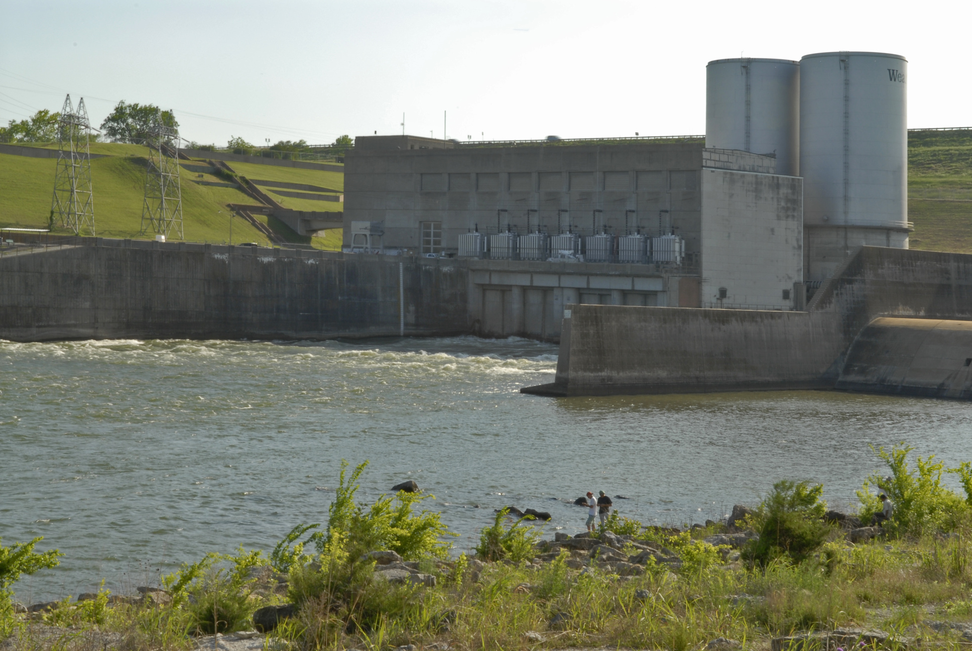
Denison Dam, which impounds Lake Texoma, caused Hagerman to be submerged. Photo by Stan A. Williams
Hagerman (Grayson County)
In the early 1870s, farmers began colonizing an area 80 miles north of Dallas that would eventually become Hagerman. Originally named Steedman for Judge S.D. Steedman of Grayson County, the town was officially established and given a post office in 1880.
The name changed to Hagerman, in honor of railroad attorney James Hagerman, in 1909 after the Missouri, Kansas, and Texas Railroad reached the town. By the next year, Hagerman had roughly 250 residents and several businesses, as well as a school, a church, a railroad depot, and a cotton gin.
The town’s prosperity was short-lived, however. The creation of Lake Texoma threatened to completely submerge the town, and by 1940, the population had dropped to about 150.
Hagerman was flooded in 1943 with the completion of Denison Dam; in total, 83,000 acres of land were submerged by the lake. While most of Hagerman is underwater, the church and cemetery remain above water level and are still visible. Periods of low water also uncover some signs of the farming town that once was.
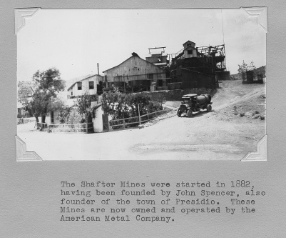
Shafter Mines in Presidio County. Photo from TxDOT archives
Shafter (Presidio County)
Known for silver mining, Shafter is located near the east end of the Chinati Mountains, about 19 miles north of Presidio.
In September 1880, John W. Spencer, a civilian employee of the U.S. Army, discovered silver ore in the Chinati Mountains and convinced three ranking officers to join him in purchasing the land surrounding the site. While they owned the land, the four men lacked the finances to mine the ore, so they sold the property to the Presidio Mining Company of San Francisco for $1,600 in cash and 5,000 shares of company stock each.
By spring 1884, large-scale excavations had begun, and the town of Shafter grew alongside the Shafter Mine as the mine hired more workers. A post office opened in Shafter in 1885, soon followed by a Catholic church and an adjoining school, a dance hall, saloons, multiple businesses, and a jail.
The mine operated until September 1942, nearly six decades after silver was first discovered. It is estimated that the Shafter Mine produced 2 million tons of silver ore, which is 90% of Texas’ entire silver output. When the mine closed due to a shortage of miners and increased production costs, the town’s population decreased sharply. At the 2000 census, Shafter had a population of 11.
A few remnants of the town remain, such as the Catholic church, vacant businesses, abandoned houses, and what remains of the Presidio Mining Company ore reduction mill.
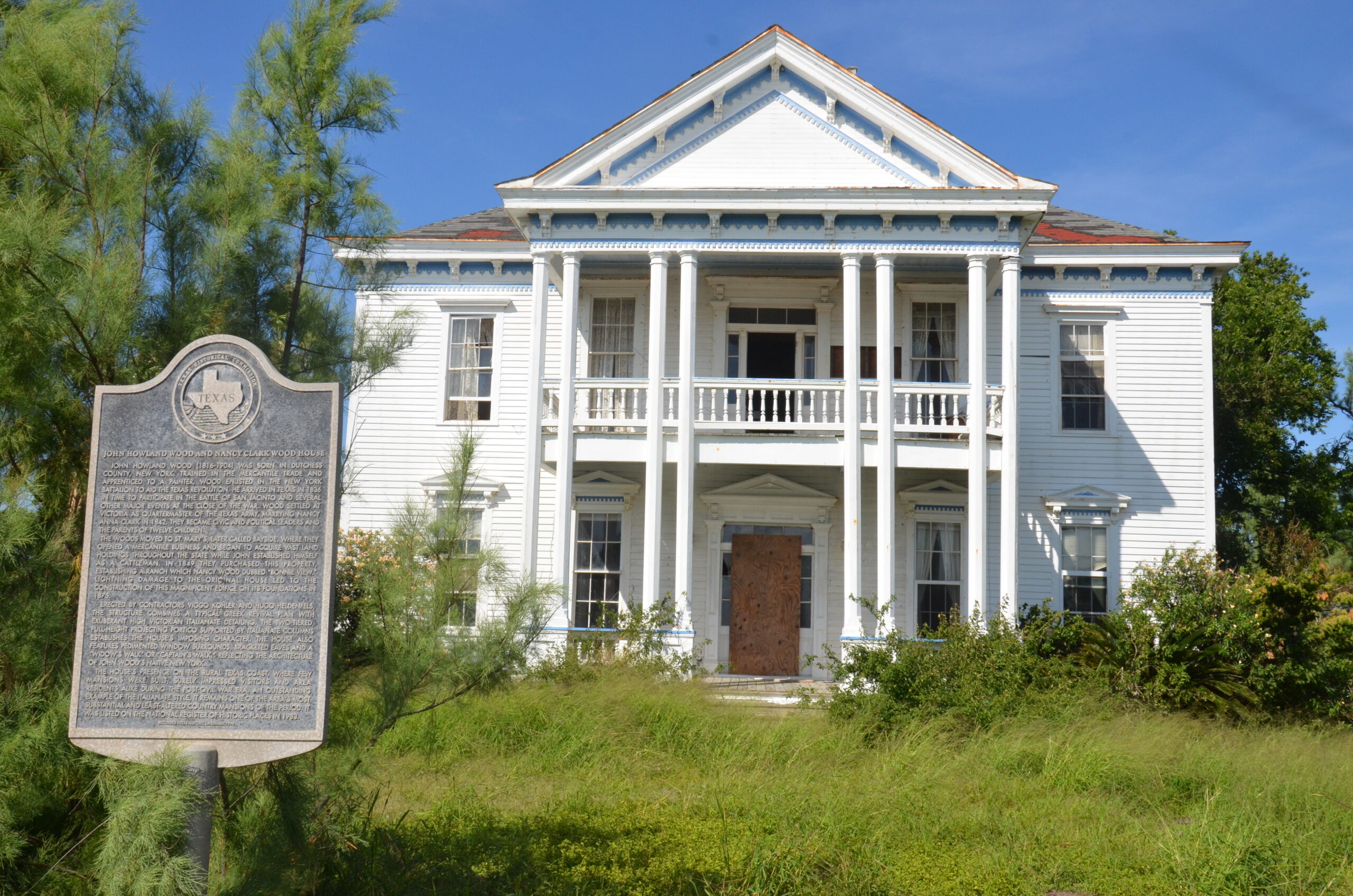
The 1875 Wood Mansion. Photo courtesy Bayside Historical Society
St. Mary’s of Aransas (Refugio County)
St. Mary’s of Aransas was founded on Copano Bay in 1850. It quickly became a major port, shipping construction materials, hides, tallow, cattle, and cotton to South Texas towns.
When many of the town’s men left to fight for the Confederacy, the coastal town was left defenseless. As a result, the port was captured by federal warships, and a wharf and two warehouses were burned. When the Civil War ended, Morgan Lines—Texas’ first steamship line—connected St. Mary’s to Galveston, Matagorda, and Brazos Santiago. The steamships, both passenger and freight, regularly made port in St. Mary’s from 1868 to 1875, when regular service stopped due to wreckage from the area’s shallow reefs.
In 1869, St. Mary’s was given the Refugio County seat, but the town lost that designation to quickly growing Rockport two years later. The loss marked the beginning of the end for the small coastal town. The San Antonio and Aransas Pass Railway built a line to Rockport instead of St. Mary’s, where it was originally planned.
A hurricane in 1866 caused massive damage to the St. Mary’s schoolhouse and wharves, and before that damage was repaired, an 1887 storm nearly destroyed the entire town. This caused the population to slowly decline, and by 1907, the post office and general store permanently closed.
The neighboring town of Bayside, founded in 1908, annexed St. Mary’s of Aransas in 1909. Though the town is now incorporated into Bayside, visitors can still see the St. Mary’s cemetery and some of the houses that survived the devastating storms of the late 19th century. Visitors can go inside the Wood Mansion, which was built in 1875 as a second home for Major John Howland Wood. Also, St. Mary’s of Aransas is the birthplace of Clara Driscoll, the “Savior of the Alamo,” and one can visit a monument dedicated to her at the site of her family’s former home.