A woman wearing an official-looking uniform holds a large brochure reading 'Pecos Trail' over a large map of Texas. Two other women, on the other side of the counter, smile as they look at the information
Jack Lewis/Texas Department of Transportation

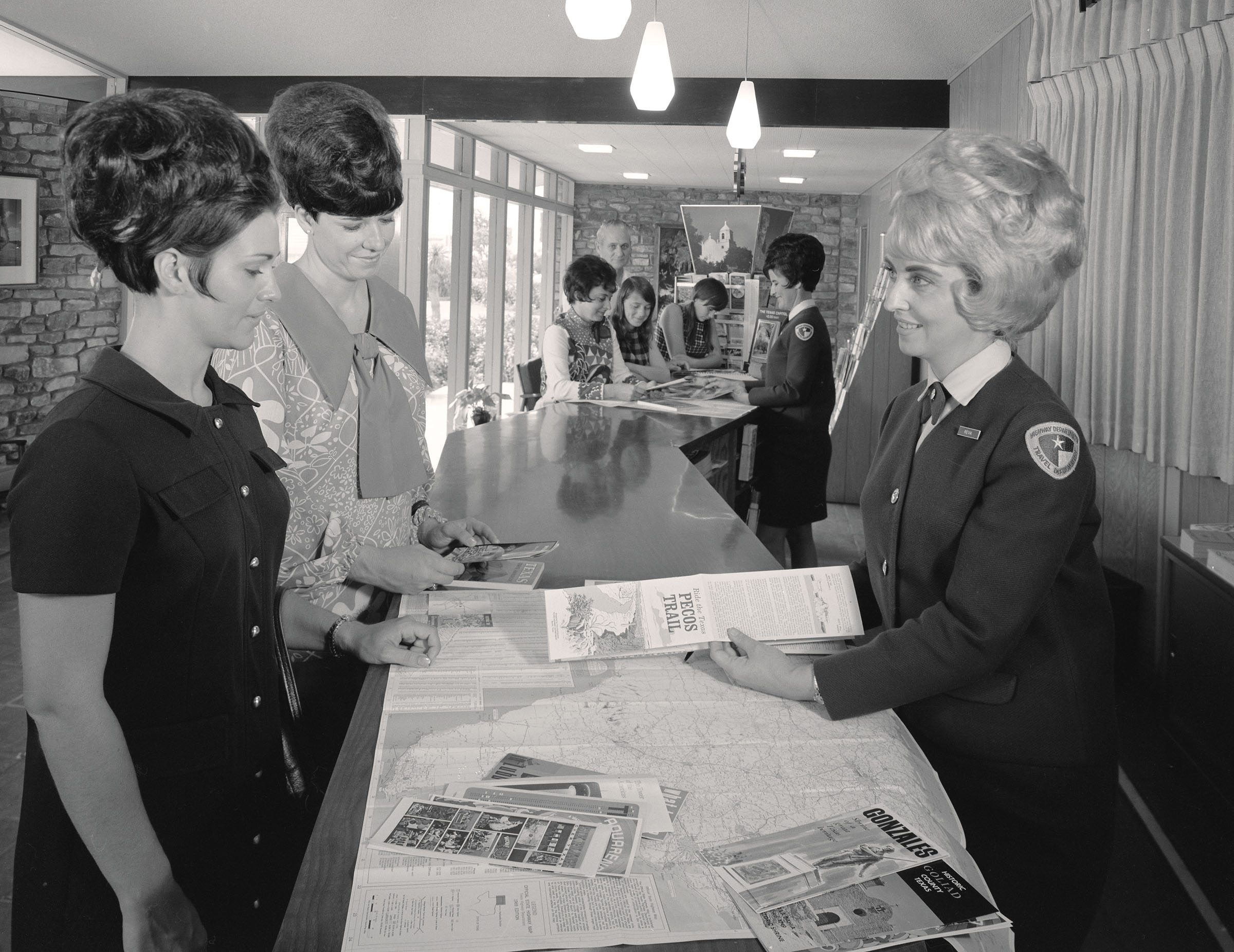
The kids won’t understand, but in the dark ages, before GPS and cellphones, motorists agonized over floppy foldable maps and dubious directions given by gas station attendants. Vacationing could feel like charting a course through the Strait of Gibraltar, or rafting down the Mississippi with Huck Finn. That’s where the Texas Travel Information Centers, the first of which opened in 1936, come in. Travel counselors are on standby at 12 centers across the state to provide current information on routes, local events, and road conditions. This Texas Highways photo, taken in 1969 by Jack Lewis, shows travel counselor Reva Keltner helping visitors inside the Gainesville Travel Information Center. Though today’s technology has made it easier for Texans to find their way, the centers still provide service with a smile to 1.5 million customers annually.

Know of any fascinating vintage Texas photographs? Send copies or ideas to [email protected]

Enjoying this article?
From the November 2024 issue

My Trips

Enter your email to bookmark Texas Highways stories and plan future travel.

Welcome back! Would you like to bookmark this story?

The email address is not signed up. Would you like to subscribe to our emails?

By clicking 'Sign Up,' you agree to receive email communications from Texas Highways. You can opt-out at any time by clicking 'Unsubscribe' at the bottom of any message. Read more about the types of emails we send on the Newsletter page.

Thanks for signing up. Click the 'Save Story' button below to bookmark this story.

You have no bookmarks currently saved. Save a story to come back to it anytime.

Get more Texas in your inbox

Sign up for our newsletters and never miss a moment of what’s happening around the state.