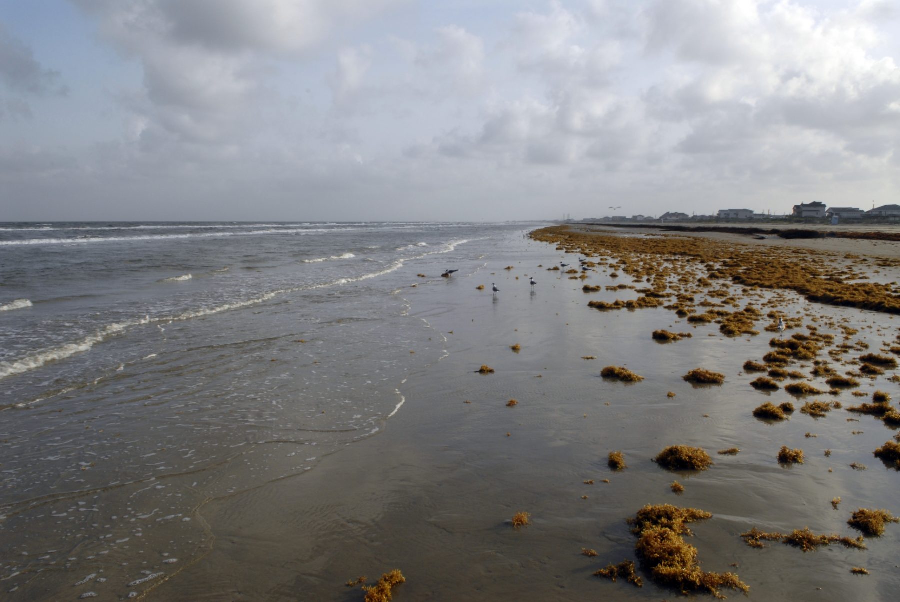
Surfside Beach in the Brazosport area is a recreation area for swimming, sailing, surf fishing, camping, shell collecting and bird watching. Photo by Kevin B. Stillman.
Since the outbreak of COVID-19, my wife and I have been laying low. Our ages and autoimmune issues put us squarely in the highest at-risk category. We wear masks and maintain social distancing whenever we go out in public, mostly to the H-E-B, the gas pump, and the closest P. Terry’s Burger Stand drive-through.
At the same time, we both have been itching to get out and get away. We’re travelers at heart. But it seems like almost every time we’ve contemplated going somewhere during the past year, we get tripped up pondering a stay at a hotel or Airbnb: strange bed, strange room, thoroughness of disinfection unknown.
Our solution? Taking a day drive. Just get in a vehicle, drive an hour or more to a cool spot, get some fresh air, take a walk or hike, eat a pre-packed meal or score some take-out at a safe distance, then drive home.
The idea came from a friend who took quick no-contact trips to several state parks over the summer. She would buy day passes or reserve an overnight campsite online in advance. Other acquaintances have been doing something similar, hitting small towns just beyond their urban city limits.
Here are a few daytrips that make getting away a safe and easy adventure. (Keep in mind mileage and time varies depending on traffic, speed, and irresistible diversions.)
The Upper Coastal Loop of Galveston Bay
Directions (starting from Houston): Start by taking Exit 810 on Interstate 10, about 40 miles east of downtown Houston. Head south on Farm-to-Market Road 563 to Anahuac and pick up Farm-to-Market Road for 10 miles to Double Bayou. Drive south on Farm-to-Market Road 562 for 17 miles to Smith Point; or from Double Bayou, take FM 563 and Farm-to-Market Road 1985 to the Anahuac Wildlife Refuge, Smith Oaks, and High Island, 25 miles away.
Time: Five hours
It may be the second largest bay complex in the United States, but too often Galveston Bay is taken for granted, or worse, ignored. Rectify that with a driving tour of the east side of Texas’ big bay, the beginning of a coastal circumnavigation of Houston.
This journey goes through Anahuac, the self-proclaimed Alligator Capital of Texas on the banks of the Trinity River, and Double Bayou, site of an historic juke joint in a rural African American community. Venture to Smith Point to overlook the least-peopled part of Galveston Bay, or visit Anahuac Wildlife Refuge, Smith Oaks, and High Island, three sites that offer some of the finest birding and wildlife viewing on the continent, rife with nature trails.
Running 25 miles from High Island down the Bolivar Peninsula is the Galveston ferry landing, where you can stay in your car and take a free ride across the mouth of Galveston Bay. Once across, detour through the Strand Historic District and Broadway Street to admire the elaborate architecture of two centuries ago, then head for Seawall Boulevard to start following the Gulf again on the left.
Getting through Galveston can be a slow crawl, especially on weekends. But once you’ve reached Galveston Island State Park—a fine stopping point if you’ve reserved a timed day pass online in advance—the road opens up as Termini-San Luis Pass Road.
San Luis Pass marks the end of Galveston Island and the beginning of Follet’s Island and Surfside. A county park across the bridge is a good spot to pause before continuing down the beach on the road that is now the Bluewater Highway, ending 14 miles later at Surfside Beach, arguably the most unassuming coastal village in Texas, near the mouth of the Brazos River.
Surfside offers walking along the Bluewater Highway Nature Trail or the Bird and Butterfly Trail, a playground at Jetty Park, and takeout options at places such as The Red Snapper Inn, La Taqueria de Surfside, Jetty Shack, or the Beach Front Deck Bar and Grill. From Surfside it’s just 8 miles on State Highway 332 to Nolan Ryan Expressway and the road back to Houston.
The Painted Churches of Fayette County
Directions (starting from Houston, San Antonio, or Austin): To get to Schulenberg, drive 90 minutes from Houston or San Antonio via Interstate 10 or 90 minutes from Austin via State Highway 71 and US 77. Sites are within a few miles of US 77 and stretch for 15 miles between Schulenburg and La Grange.
Daytrip time: 3 to 4 hours
For this trip, we set out for Schulenburg, a town of 2,800 founded by Germans with a significant Czech population. After picking up a Painted Churches map at the Chamber of Commerce and Tourism Center for $5, we looked around downtown Schulenburg, where we found takeout food at Tillie’s across the street from the chamber, the historic Senglemann Hall a block away, and the Stanzel Model Airplane Museum a few blocks over.
We poked our heads in at the Texas Polka Music Museum to check out artifacts from the area’s most popular indigenous music. Next time, we’ll buy a CD at the museum so we can have an appropriate soundtrack for touring the churches.
Off we went to Dubina, about a 10 minute drive away. Crossing the funky one-lane suspension Piano Bridge, built in 1885, we found the oldest Czech-Moravian community in Texas. Established in 1857, Dubina is a classic presentation of cemetery, church, and adjacent dance hall—the essentials of Czech and German immigrant farming communities in the area. The church of Sts. Cyril and Methodius Catholic Church was built here in 1911 following the storm of 1909 that pretty much destroyed the settlement of Dubina.
From Dubina we drove north through Ammansville to Swiss Alp, where we passed by the close-to-derelict remnants of the dance hall that gave BJ Thomas his start on our way to the Philadelphia Evangelical Lutheran Church. Founded by German-Swiss immigrants, this church was built in 1890 and is pretty enough but nowhere near as elaborately painted as the other Catholic churches on this trail, such as St. Mary’s at High Hill. A Gothic Revival sanctuary, St. Mary’s was erected by the Austrian immigrant community with the arches and columns of a European cathedral.
Further west in Freyburg is the remnant of a German settlement and site of the sole Methodist Church on the tour. Built in 1878, the church has its original wooden benches and altar and a minimalist interior, minus embellishments beyond the exterior steeple.
Our tour wrapped at St. Mary’s Church of the Assumption of the Blessed Virgin Mary, 10 miles west in Praha, near Flatonia, just off US 90. This was the most impressive sanctuary. The celestial robin’s egg blue vaulted ceiling with trompe l’oeil ribs made to look like stone were painted by Godfrey Flury, a Swiss immigrant from nearby Moulton, in 1895 and never touched up.
If we had started earlier, we could have budgeted time for a hike around Monument Hill overlooking La Grange, site of the historic Kreische Brewery. But three hours in Fayette County was enough of a purposeful meander along country roads with sites that take you back in time and remind you what these churches, ranging from starkly simple to Sistine Chapel magnificent, meant to the area’s immigrant population.
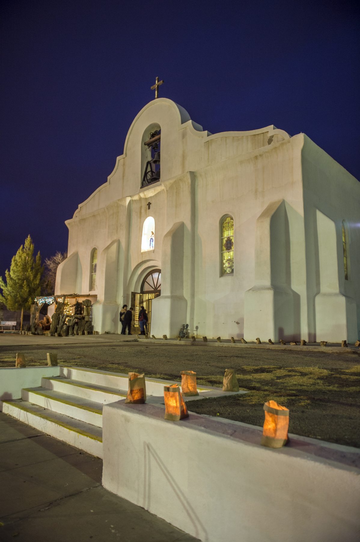
San Elizario Presidio Chapel. Photo by Kevin B. Stillman.
The Real Old El Paso Drive
Directions (starting from downtown El Paso: From downtown, take Loop 375 Expressway 11 miles to Exit 48, Socorro Road, then 8 miles to San Elizario and San Elizario Presidio Chapel.
Daytrip time: About four hours
Take a step even further back in history exploring the missions and chapels near El Paso. They’ll put you in another frame of mind, no matter where you’re coming from. But before setting out, I advise mapping out an itinerary with the El Paso Mission Trail website.
The missions of the lower Valley of El Paso (Ysleta Mission, Socorro Mission, and San Elizario Presidio Chapel) offer a glimpse back in time when Spanish explorers established a trade route up the El Paso Valley and, with the help of Spanish missionary priests, attempted to “civilize” the natives farming fields nourished by a mightier Rio Grande and convert them to the Catholic faith.
Starting at San Elizario and San Elizario Presidio Chapel, you can take a self-guided walking tour of the town’s historic district, with remnants of one of the oldest villages in the country.
Backtrack slowly for 7 miles along the historic Socorro Road to Mission Socorro and La Purisma Catholic Church. It’s another 3 miles on Socorro Road to Old Mission Ysleta. Ysleta is the first and oldest mission established in Texas with the second oldest continually active Catholic parish in the United States.
Ysleta Pueblo Del Sur has strong ties to the Tigua tribe, some of the valley’s first residents, who settled here following the Pueblo Revolt of 1619 in New Mexico. The mission’s connections to the people is explained at the Tigua Indians and Ysleta del Sur Pueblo Cultural Center, located at 305 Yaya Lane. Along with a museum, the center has gift shops that sell authentic merchandise created by local artisans.
It’s important to note that these are active churches, not just historic remnants. As they put you another frame of mind, be mindful and respectful when you enter them.
Padre Island National Seashore
Directions (from San Antonio): Two and a half hours via Interstate 37 South, South Padre Island Drive, and Park Road 22.
Time: 12 hours
In mid-November, my wife and I celebrated our 40th wedding anniversary with a day drive from our Wimberley residence to the Padre Island National Seashore and back. Kris made sandwiches and packed some fruit, water, and other beverages. With a full tank, we left the house before daybreak to beat rush hour traffic around San Antonio. The rest of the drive on I-37 and SPID Expressway was direct, uncrowded, and effortless.
At the national seashore entrance, I showed the gate attendant my national park visitor card. (Without a card, one-day admission to Padre Island National Seashore is $10.) We then drove past the headquarters at Malaquite Beach and headed south on the sand, the start of a 60-mile beach drive to the Port Mansfield Cut, the longest undeveloped stretch of barrier island in the United States.
Two miles down the beach was empty enough to stop. A cold front had blown in overnight and it was still blustery and cool, despite the 70-degree temperature. We walked the wet sand and watched gulls and pipers, who stood at water’s edge, occasionally picking at the sand for freshly deposited coquina. Squadrons of pelicans flew by, feeding at low tide. We reveled in the abstract beauty of sand, sea, and sky while enjoying each other’s company.
After eating our sandwiches while watching the waves and the shorebirds, we drove back to Malaquite Beach and walked for a mile before driving over to Bird Island on the west side of the skinny island fronting Laguna Madre. There, we scaled a pile of rocks on the edge of the laguna.
It was a great time to be by the water. Human presence was minimal. The wildlife didn’t seem to mind.
On our return trip, we paused under the JFK Causeway back to the mainland for fried shrimp at the open-air restaurant Snoopy’s. We dined dockside watching pelicans dive bomb while porpoises broke the water surface behind them. With a single gas stop near Pleasanton, we arrived back home where the sleeping accommodations, I’m pleased to report, were splendid, safe, and familiar.
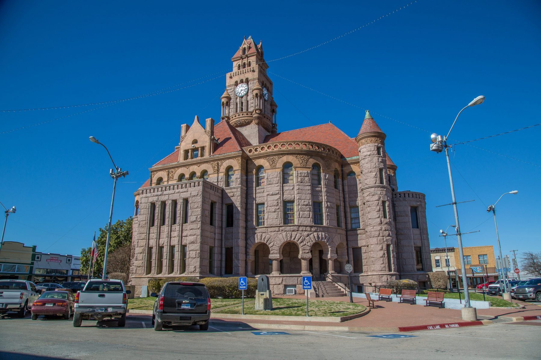
Wise County Courthouse in Decatur. Photo by Will van Overbeek.
Cross Timbers Cowboys and Native Americans
Directions (starting from Fort Worth or Dallas): To get to Decatur, drive 40 miles northwest of Fort Worth on US 287/81, or 65 miles from Dallas on US 287/81, State Highway 114, or US 380 and Interstate 35.
Time: Seven to eight hours
Cattle drives, stagecoach routes, frontier forts, and sites of battles and skirmishes between white settlers and Native Americans hostile to the settlers’ encroachment tell some stories about the area known as the Cross Timbers northwest of Dallas-Fort Worth. This area is also home to some of the most beautifully designed courthouses in the state.
In Decatur, take a look at Wise County’s multiple-steepled granite Romanesque Revival courthouse, built in 1897 by J. Riely Gordon, the same architect who conjured the equally majestic and phantasmagorical Ellis County courthouse in Waxahachie. (Another over-the-top edifice worth peeping at in Decatur is the WT Waggoner mansion, or El Castile, built in 1883.)
Proceed west past Runaway Bay to Vineyard, then detour to Wizard Wells, where you can find the remnants of a mineral spa from more than a century ago. Then it’s 37 miles between Decatur and Jacksboro, where the point of interest is Fort Richardson, one of a cluster of frontier forts constructed before 1860 to ward off the Comanche and Kiowa. You can choose between two-hour ranger guided tours Tuesdays and Fridays or a self-guided tour of historic buildings open on Saturdays and Sundays.
Next comes Possum Kingdom Lake. As far as dammed-up rivers go, Possum Kingdom is one of Texas’ prettiest impoundments, flanked by steep limestone cliffs in canyons carved by the upper Brazos River. Possum Kingdom State Park is on the west side of the lake. Pick up State Highway 16 for 25 miles to Strawn and stop for world-class chicken fried steak at Mary’s Café.
From there, if you head toward Mingus, you’ll find a scattering of historic honky-tonks; or, head to Thurber, a once prosperous coal-mining town famous for its bricks. A scattering of buildings remains in this ghost town, as well as the centerpiece 128-foot high brick smokestack built in 1908.
From Thurber, it’s 41 miles to Weatherford and the last cool country courthouse on this adventure. The wooded thickets and the biggest hills near DFW are worth the day drive, but the sparsely settled communities, many of which appear to have seen better days, and the temporary quality of the construction of what modern structures there are in the red clay soil, make this territory still feel unsettled, just like it did 150 years ago.
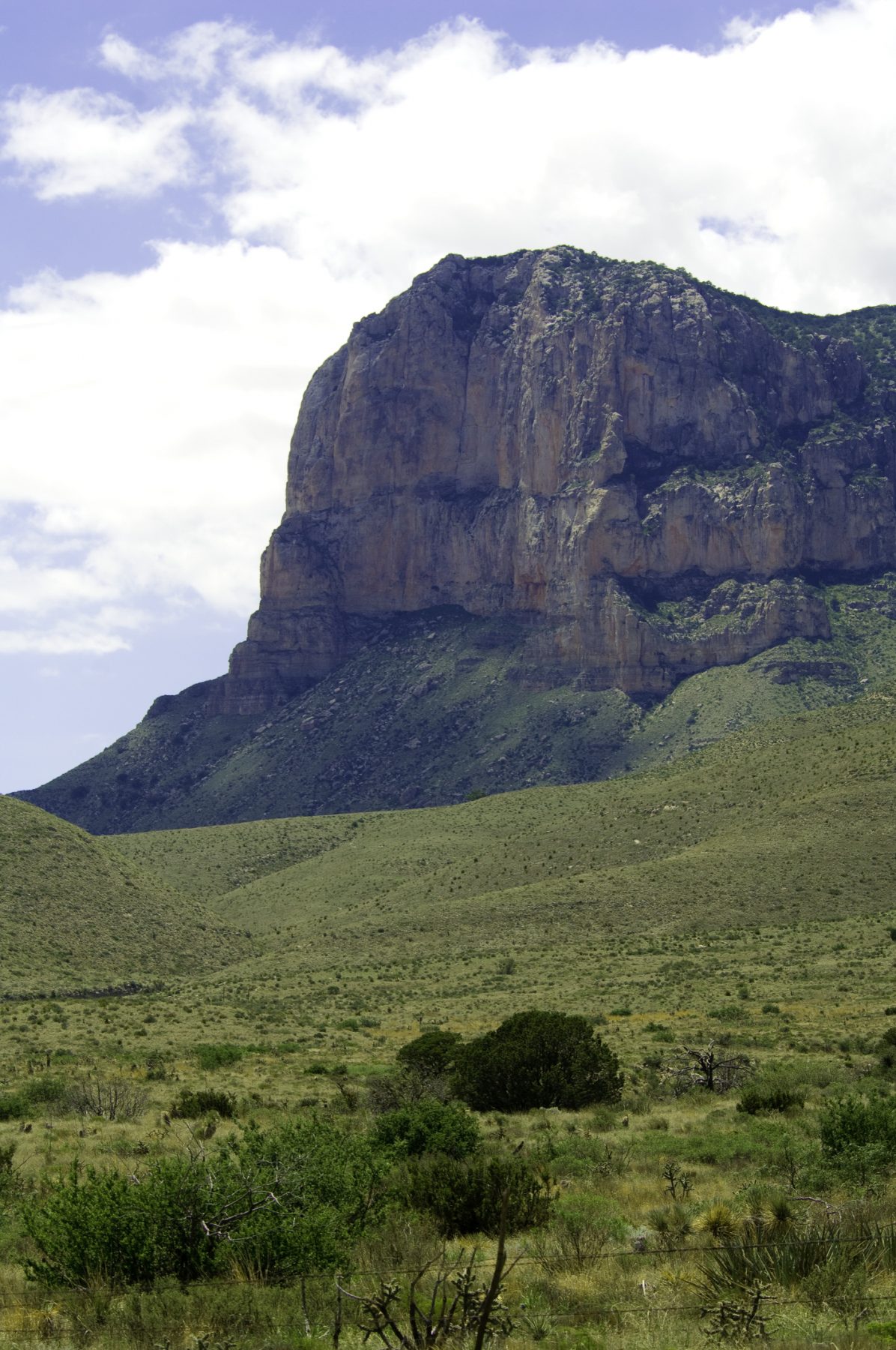
Guadalupe Mountains National Park. Photo by Stan A. Williams.
Guadalupe Mountains Drive
Directions (starting from El Paso): Drive an hour and 45 minutes on US 62/18 to Guadalupe Mountains National Park.
Time: About 7 hours
To most mobile El Pasoans, a driving getaway means New Mexico—either Cloudcroft, Ruidoso, Silver City, or Mesilla/Las Cruces at the very least. It’s time to discover your Texas Mountains.
Head east on Montana Avenue, which eventually turns into US 62/18, and turn left at Farm-to-Market Road 2775, about 5 miles beyond the city limits. Follow the signs to Hueco Tanks State Park and Historical Site. Hueco is a jumble of petroglyph-adorned boulders amidst the desert mountains that is a favorite winter destination for climbers from across the world.
Back on US 62/180, it’s about an hour to Dell City, a very unusual farming town off the highway with the best views of the Guadalupe Mountains, Texas’ tallest range. Dell City is 42 miles from the headquarters of Guadalupe Mountains National Park and the trailhead for most of the park’s lower trails and to Guadalupe Peak.
The entrance to McKittrick Canyon, one of the sites in this part of West Texas where fall colors are guaranteed, and accessible only on foot, is 11 miles further. Then it’s two hours back to El Paso.


