With pleasant late-September temperatures and a picture-perfect blue sky overhead, I shrugged on a backpack loaded with overnight gear and made fast-minute hiking plans with friends in the Basin parking lot of Big Bend National Park. Above us towered the craggy heights of the Chisos Mountains, daring us to hike up into the rocky peaks.
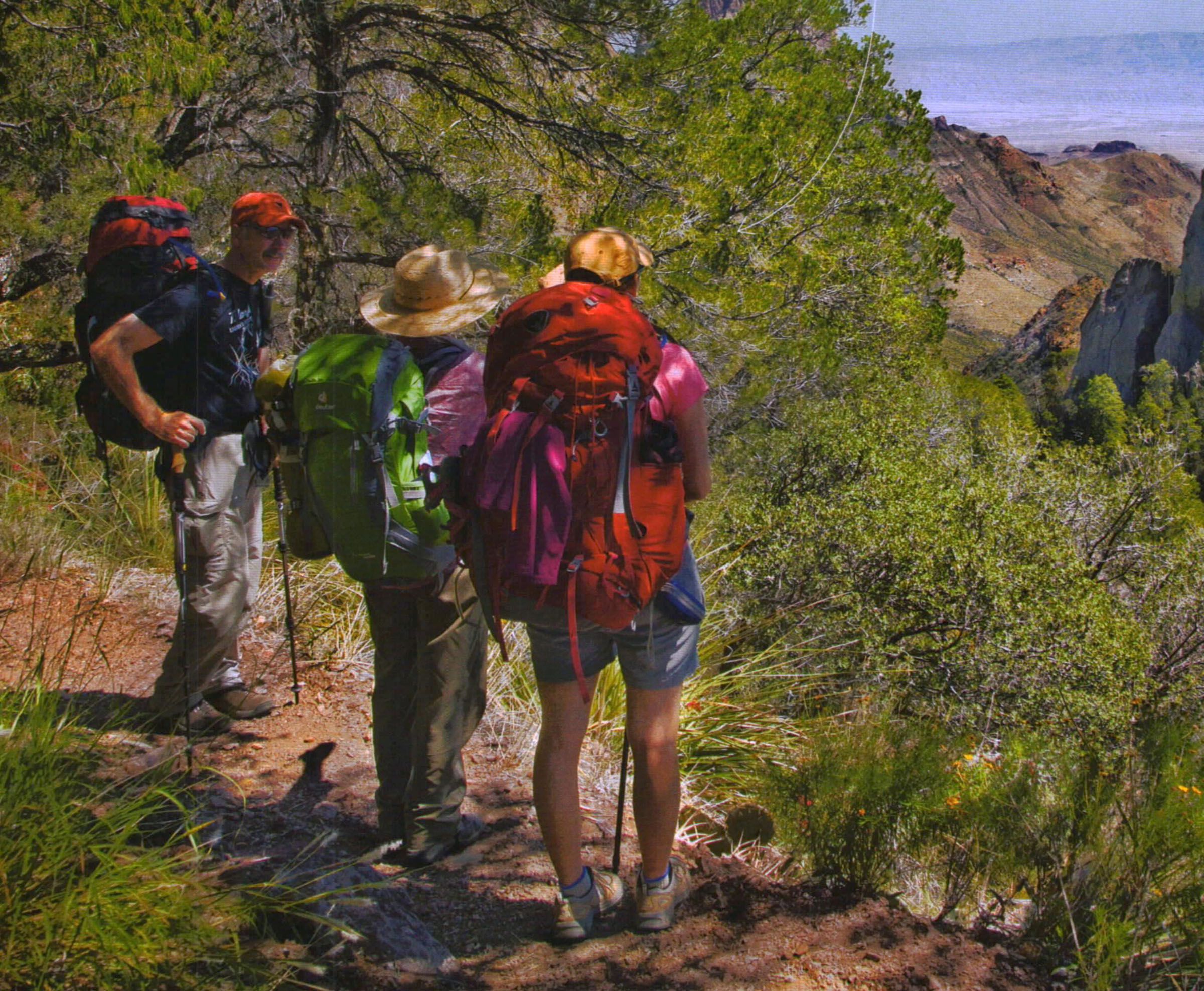
John Morlock, Heather Ainsworth-Dobbins, and Mary Baxter taking a breather on the Boot Canyon Trail.
The four of us—Heather Ainsworth-Dobbins, Mary Baxter, John Morlock, and I—had gathered here to hike to the park’s famous South Rim, a strenuous, U.6-rnile, round-trip hike that climbs more than 2,000 feet and affords spectacular views stretching clear into Mexico. It’s possible to do the hike in a single long, exhausting day, but we planned to camp for a few nights to fully enjoy the views, the solitude, and the park’s brilliant sunrises and sunsets.
I had heard that many of the mountains’ trees had died during the extended drought of 20ll, and I wanted to see if the rumors were true. There are two main routes to the South Rim-the steep Pinnacles Trail and the more gradual Laguna Meadows Trail. We figured we’d take the hard way up and the easier route back, so we started up the Pinnacles Trail, admiring the lush green grass and abundant wildflowers. Recent rains had obviously started the mountains on the road to recovery. As we climbed, though, scattered damaged trees showed that the drought had indeed been tough on Big Bend.


John Morlock, superintendent of Fort Davis National Historic Site in nearby Fort Davis, previously worked in Big Bend National Park as a ranger, and before that, as the park’s fire management officer. He estimated that half of the pinyon pines here—the Chisos High Country’s dominant tree—had been severely compromised during the drought. He explained that the lack of water had stressed the pines, and bark beetles had then infested them, further weakening the trees. ”By the springtime growing season,” he said, “it will be evident which ones will make it and which ones won’t.”
And so life continues. As we sweated our way up the steep trail, John pointed out the twisted, white-barked aspens at the base of Emory Peak and the sheer ramparts of Casa Grande Peak, which reminded us of a castle.
“I love the South Rim,” said Heather, catching her breath. “But right now, I’m not nuts about the Pinnacles Trail.”
Mary smiled and offered, “I appreciate that the route home will be downhill.”
We stopped for some trail mix and dried fruit in the shade of maple and oak trees just before reaching the saddle between Emory Peak and Toll Mountain at the high point of the Pinnacles Trail. The saddle-a “low” point between hills-marks the entrance to the park’s official High Country. Here, swaths of skeleton-leaf goldeneye, mountain sage, and scarlet bouvardia lined the trail.
Although John was pained to see the struggling pines, “a thinning of the high Chisos forest was needed for long-term health,” he told us.
We dropped into Boot Canyon, stopping at Boot Spring to obtain and filter water. Before the hike, we had checked with park rangers about the spring’s status, as it’s often unreliable. When Boot Spring is flowing, a multi-day hike-and-camping adventure is much easier since you don’t have to carry three days’ worth of water. Lucky for us, the recent rains had not only spurred the flowers into an incredible bloom, they had also rejuvenated the spring.
A few of the tall Arizona cypress trees here had succumbed to the drought, but most trees in the sheltered canyon had made it through. We were too early in the fall to see the maples in full color, but they looked healthy and green. Yellow butterflies fluttered around the many pools dotting the rock canyon bottom.


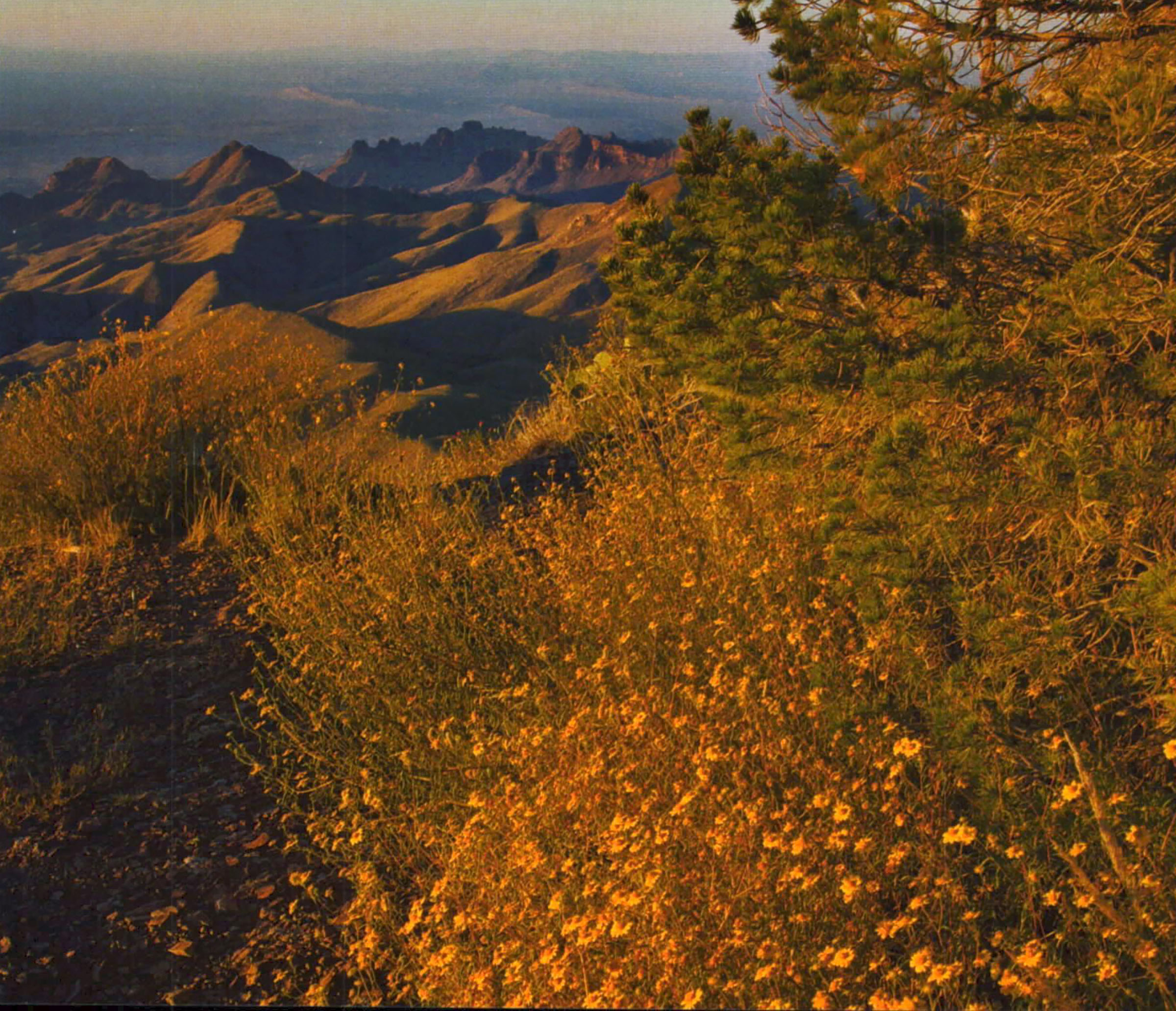
Although all of us had seen it before, the view where the Boot Canyon Trail meets the South Rim Trail brought exclamations of joy. Here, the South Rim drops off abruptly in a sheer cliff just beyond the trail junction. Thousands of feet below unfold the Chisos foothills, and in the far distance, almost lost in the vast expanse of desert, flows the tiny green ribbon of the Rio Grande. We admired the view for a few minutes, but soon our shoulders protested the weight of our now water-filled packs. We hiked the short distance northeast to our reserved campsite, where we happily shed our packs, set up tents, and relaxed in the shade of oaks and pinyon pines as we cooked dinner.
After refueling our bodies, we picked up jackets, headlamps, and cameras and walked the easy¾- mile over to the South Rim. The trail hugged the rim, offering spellbinding views of the endless ridges and hills below. Looking east, we could see the Sierra de! Carmen range of Mexico, and above and below us, peregrine falcons and ravens soared gracefully in golden sunlight. We were so distracted by the abstract patterns of golden light and dark shadows highlighting the canyons below that we made it to the South Rim only minutes before the sun dipped below the western horizon.
“How many hikes allow us to see into a different country and imagine ourselves as explorers in the Wild West?” Heather asked. “I love to sit up here and picture a lone cowboy riding on a ridgetop.”
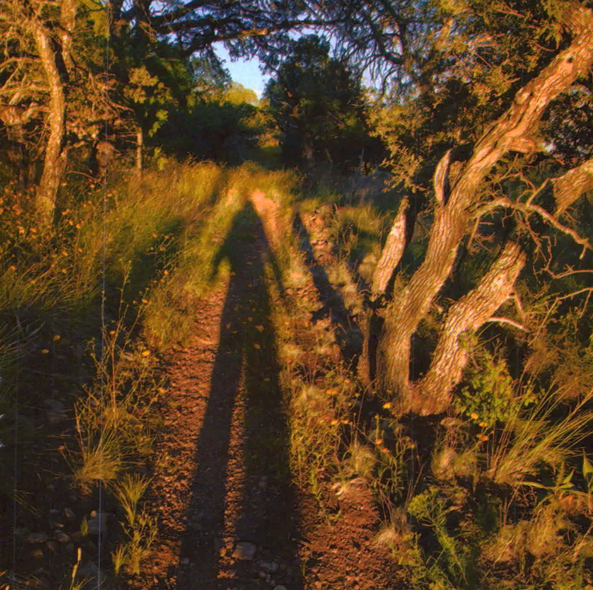
We crawled into our sleeping bags that night tired and happy. The next morning, we got up before dawn to watch the sun peek over the Sierra de! Carmen. The slanting golden rays cast long shadows over the desert below and illuminated the high country with pink and gold. We spent the day hiking the loop out to the Northeast Rim, then down into Boot Canyon to replenish our water supply, taking photos all the way. After returning to our campsite and fixing a freeze-dried dinner, we sat on the Rim through another glorious sunset until the light had faded from the sky. The next morning, after sunrise and a granola breakfast, we took down the tents and reluctantly packed our gear.
Via the South Rim Trail, we hiked to the Laguna Meadows Trail for a gentler descent back to the Basin trailhead. Fields of goldeneye distracted me constantly, demanding more photos. Slowly we descended, passing more aspens, this time high on the south slope of Emory Peak, and the tall, lush grass of Laguna Meadows.
“The South Rim view is the obvious spectacular place, but the meadows are really nice in a quiet way,” Mary noted.
We arrived at our cars by late morning. We looked forward to a big meal and a shower, but as we drove out of the Basin, I caught my hiking partners eyeing the high peaks more than once. I knew that we would all be back.