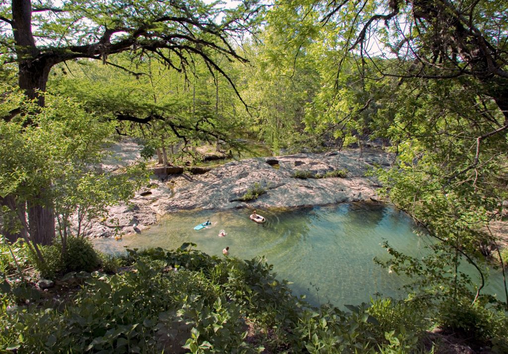
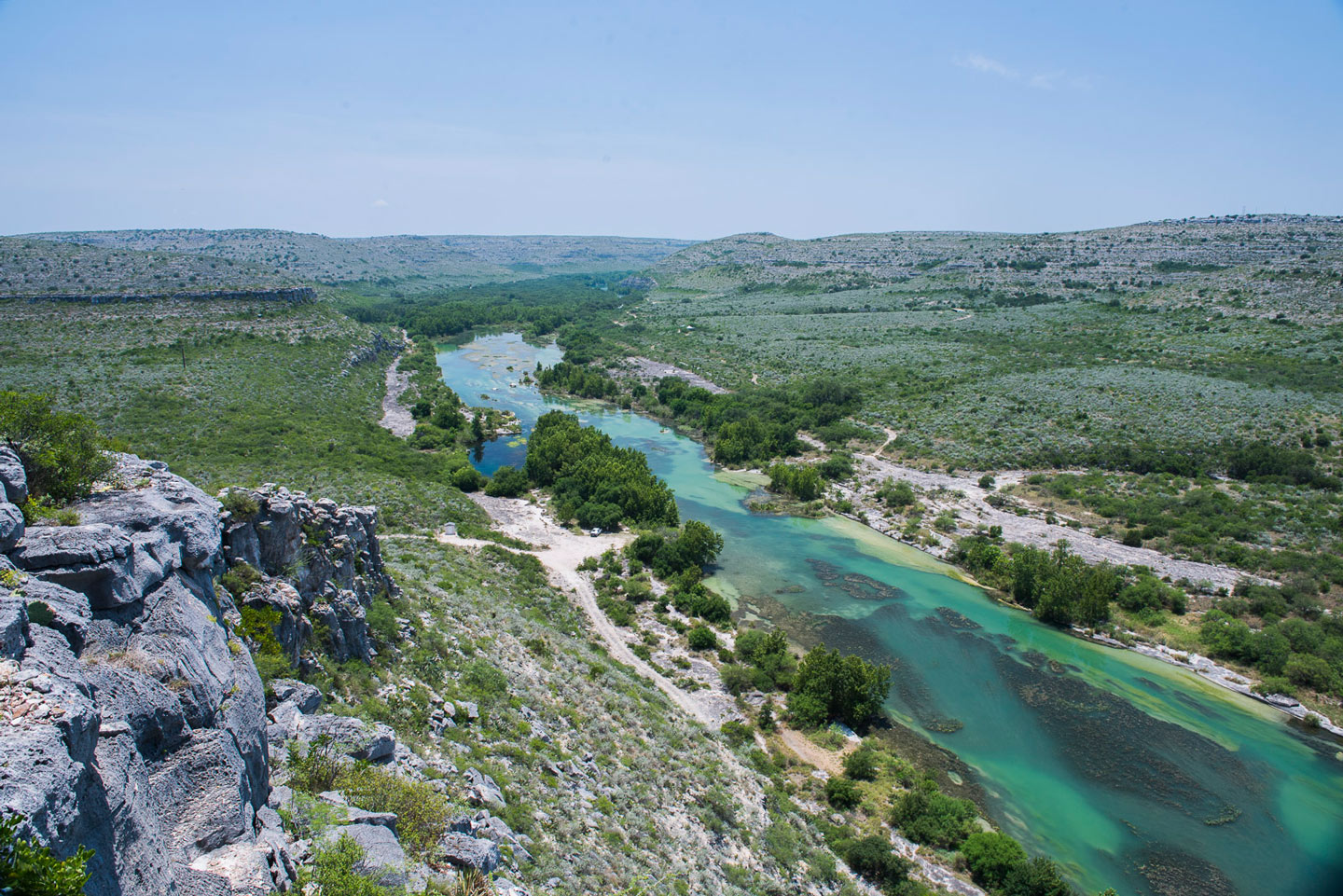
I was pondering this thought one morning on the river as I clambered out of my kayak to perch on a boulder and peer 100 yards downstream at a serene pool flanked by sloping slabs of limestone. In between lay Dandridge Falls, a series of cascading rapids that coursed and swirled through chutes, over small ledges, and around protruding boulders and brush.
You find two kinds of paddlers on the Devils River: those who come out here whenever possible and those who will never do it again. Or so the saying goes.
Dandridge wasn’t the most menacing rapid I had encountered on my maiden voyage down the Devils River in Southwest Texas. But I was leery because another member of my group had broken a thumb here on a previous expedition, his knuckle crushed between his tipped canoe and a rock.
Map illustration: Peter Hoey

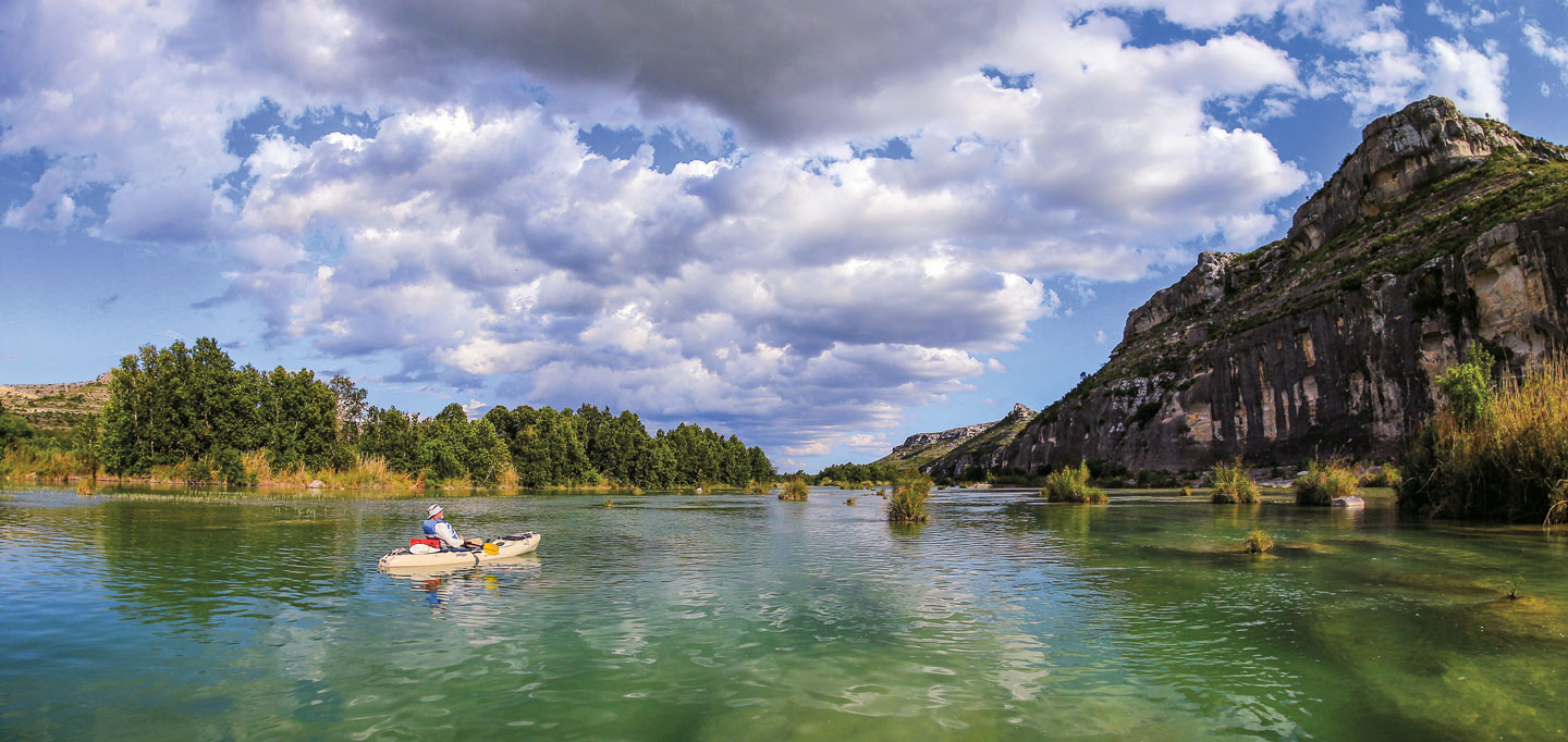
I tested my luck more than a few times on my three-day, 15-mile journey down the Devils River, a spring-fed tributary of the Rio Grande that snakes a sparkling turquoise path through the bulging limestone bluffs and rugged hills of Val Verde County. One of the state’s cleanest and clearest rivers, the Devils challenges paddlers with a remote adventure through scenery unlike anywhere else in the state. For those who prefer dry land, the 30-square-mile Devils River State Natural Area offers equally isolated hiking, camping, wildlife viewing, and stargazing.
But as I experienced on the Dandridge Falls rapids, the exhilarating rewards of the Devils River don’t come without meeting its diabolical demands.
“The name alone is intimidating,” noted Joe Joplin, superintendent of Devils River State Natural Area. “The river and the area in general has a bit of a lore about it, that you’re not welcome here either by the people who live here or by some spiritual thing. And then there’s the remoteness and the fact that everything out here attacks, be it pokes, stings, or rattles. All of those things together build the sense that it’s wilder than everywhere else.”

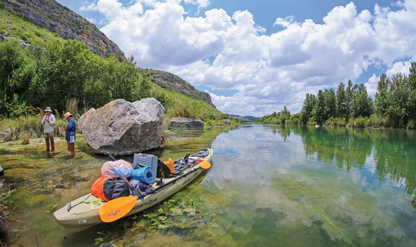
We budgeted time in our itinerary to explore the river’s pools and to fish for bass, sunfish, and catfish. Photo: Jack Johnson
The physical challenge, combined with the river’s isolation and state permitting requirements to access it, make a Devils River paddling trip an exercise in both endurance and logistics. To make the most of my expedition, I recruited three experts to join me: John Karges, associate director of field sciences for The Nature Conservancy of Texas; Jack Johnson, a seasoned paddler and the park archeologist for Amistad National Recreation Area; and freelance photographer Matt Johnson (no relation), a former professional fishing guide who knows his way around a river.
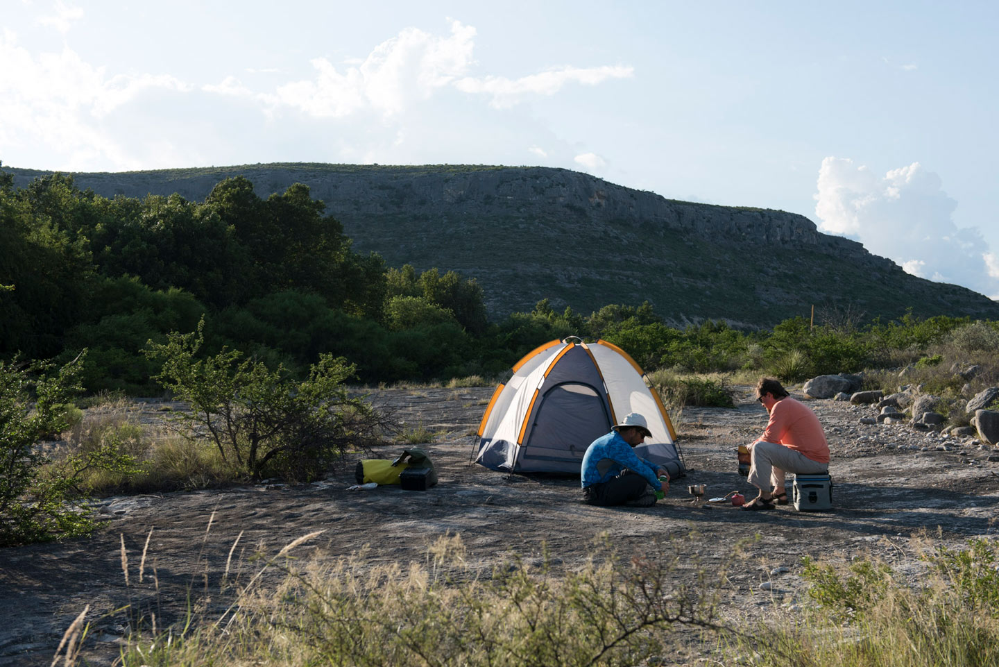
On a Monday morning last June, the four of us congregated about 20 miles north of Del Rio at Amistad Expeditions, which provides shuttle services and kayak rentals. The shuttle driver dropped us off at the state natural area’s Del Norte Unit (river mile 15) with plans to meet us three days later at the Dan A. Hughes Unit (river mile 30). We strapped our camping gear and supplies onto the boats and launched under the midday swelter of a pale-blue sky.
The Devils River flows about 45 miles from its headwaters at Pecan Springs, located on a private ranch, to its confluence with the Rio Grande in an area that’s part of Lake Amistad. With each bend in the river, we encountered another breathtaking view (marred slightly by a stretch of ranchettes called the Blue Sage subdivision). We floated over spring-fed pools that looked like aquariums of plants and fish and paddled past lush riverside forests where birds flitted and chirped. At times, our route cut directly through limestone banks, the rock ascending from the river bottom up to 500-foot bluffs overhead. Evenings brought fast-moving cumulus clouds, winds that roughed wide-open plates of calm water into rippled expanses, and sunsets like fired molten glass turning slowly across the navy sky.
Ancient Ingenuity
Humans have inhabited this region for at least 13,000 years, drawn by water, game, and the safe harbor of rock shelters in the limestone cliffs. “They came for the same reasons we’re here,” said Jack Johnson, who’s known for his facility with an atlatl, an ancient spear-throwing tool that natives used for hunting. “There are fish in the river and good clean water to drink and lots of food resources—pecans, walnuts, game. It’s a good place to live.”
Humans have inhabited this region for at least 13,000 years, drawn by water, game, and the safe harbor of rock shelters in the limestone cliffs.
Remarkably, these early Native Americans left behind colorful paintings on the walls of rock shelters across this region—known in archeological terms as the Lower Pecos Canyonlands—chronicling their lifeways and spiritual tales. From the river, we saw one such pictograph at Turkey Bluff (on a high terrace on private property). These paintings depict a blackish turkey and a burnt-orange animal that could be a dog or a deer. Johnson said the Turkey Bluff pictograph is in the red monochrome style, meaning it was probably painted within the last 1,300 years.

Paddling the Devils reveals rare sights like the Turkey Bluff pictograph. Photo: Jack Johnson
Like the ancients before us, we were drawn to the Devils River in part because of its bounty of fish, including smallmouth bass, largemouth bass, sunfish, catfish, and freshwater drum. (For bass, catch-and-release rules apply above Lake Amistad.) While we had modern fishing rods, the natives relied on simple yet effective implements to catch their meals. Johnson said archeologists have found lures made from the curved spines of fishhook cacti, tied together like treble hooks and adorned with fluff similar to artificial flies. The natives also used nets to catch fish and likely used weirs made of rocks and sticks to funnel fish into baskets. Evidence in nearby Mexico suggests natives in the region may also have used lechuguilla juice to poison fish pools, Johnson said.
“If you put us out here with nothing but the shirts on our backs, it would be a survival situation,” Johnson said. “But for those guys, this was everyday life for them. They did it successfully for countless generations over thousands of years. They were tough and smart, and this was their home, grocery store, and pharmacy.”
Read More
The first Westerners to encounter the Devils River were Spaniards in the 16th century who ventured up from modern-day Mexico, then part of New Spain. The Spanish called the Devils the Rio San Pedro, historian Patrick Dearen recounted in his book Devils River: Treacherous Twin to the Pecos, 1535-1900. Starting around 1700, raiding Apaches, and later Comanches, bedeviled Spanish settlements on both sides of the Rio Grande. In the 19th century, the first American trailblazers encountered the same dangers when they started building trade routes and military roads across these treacherous canyons.
The exact origin of the “Devils River” appellation is uncertain, Dearen wrote, but one account credits Texas Ranger John C. Hays, who in 1848 scouted a trail between San Antonio and El Paso. “Saint Peter, hell! It looks more like the Devil’s River to me,” Hays exclaimed (presumably referencing the pearly gates). Later, in his expedition report, Hays wrote, “Owing to the difficulties we had in extricating ourselves from the deep ravines and mountains which encompass it for many miles from its mouth, we named it Devil’s River.”
The Next Bend
The same jagged isolation that tormented explorers is what makes the Devils River a natural wonder for outdoors adventurers today. Three eco-regions converge around the river—the Edwards Plateau Hill Country, Chihuahuan Desert, and Tamaulipan Thornscrub—resulting in a rich mix of plant and animal life. Imagine riverside forests of live oak and sycamore typical of the Hill Country butting up against steep escarpments where desert ocotillo plants and brushland huisache trees cling to the limestone cliff.
“The biodiversity is incredible,” remarked Karges, the Nature Conservancy biologist. “You never know what’s around the next bend. You never know what you’ll detect. It changes throughout the day; it changes throughout the seasons.”
Karges, who formerly managed The Nature Conservancy’s Dolan Falls Preserve on the Devils River, served our party as a floating search engine of biological facts. His bird list for the trip counted 51 species, including all three types of kingfisher—ringed, belted, and green; the white-tipped dove, with a coo that sounds like someone blowing over the top of a Coke bottle; canyon wrens, with their comforting refrain of descending whistles; and a zone-tailed hawk, a majestic black raptor with white bands across its tail.
“The name alone is intimidating. And then there’s the remoteness and the fact that everything out here attacks, be it pokes, stings, or rattles. All of those things together build the sense that it’s wilder than everywhere else.”
Karges also showed us delicate mountain pink flowers growing improbably from limestone boulders, and he explained how the sycamore trees along the Devils are the westernmost naturally occurring sycamores in Texas. He told the story of discovering Mexican white oak trees at Dolan Falls Preserve, the only natural stand of the species in the United States. Some autumns, Karges said, monarch butterflies migrate south down the Devils corridor, lighting on live oaks like millions of delicate chandeliers. And he pointed out water creatures that rely on the Devils’ pristine spring water, such as the threatened Devils River Minnow (found only here and in nearby Rio Grande tributaries), the headwaters catfish, and the Rio Grande cooter, a slider turtle.

A view of the river from the Devils River State Natural Area’s southern unit. Photo: Jack Johnson
“All of these things in concert lend to the biological importance of the Devils River in Val Verde County—three ecoregions and a clean, spring-fed source of river water,” Karges summated.
We stopped for a moment to marvel at the power of the water thundering off the 15-foot cliffs, like whitewater pouring through huge limestone fingers.
The Edwards/Trinity Aquifer feeds the springs that create the Devils River, including Dolan Falls, the largest-volume waterfall in the state of Texas. In 1991, The Nature Conservancy acquired Dolan Falls Preserve (closed to the public) and over time has secured conservation protections for 163,000 acres of land within the Devils’ watershed to help shield it from human industry and development. At any given time, numerous scientists are studying the water, plants, and animals at Dolan Falls to monitor the health of the river in the face of potential disturbances from water pumping and oil-and-gas drilling.
Dolan Falls proved to be the most significant hazard on the river. Taking our cue from warning signs painted on bankside boulders, we portaged around the falls, getting out of our boats and carrying them down the rocky shelves where shallower water flowed around the main cascades. Then we stopped for a moment to marvel at the power of the water thundering off the 15-foot cliffs, like whitewater pouring through huge limestone fingers.
Risk and Reward
Hazards like Dolan Falls give the Devils River its edge. Wherever we were on the river, we kept an ear downstream listening for the approach of cascades. The serenity of slow-flowing pools inevitably gave way to the growing roar of whitewater where the river narrowed and the current accelerated into class 1, 2, or 3 rapids.

Dolan Falls is the highest-volume waterfall in Texas. Photo: Matthew Johnson
The rapids bucked me off my kayak several times as I tried my best to steer around boulders and navigate drop-offs and channels. (I avoided injury but I broke a fishing rod and soaked some of my gear.) I chose to “line” my boat through a couple of rapids, meaning walk my boat down the river while holding the stern rope. Lining may have been safer than running rapids, but it was less fun too, considering the challenge of keeping balance in a swift, knee-deep current while picking my steps across irregular boulders shaped like basketballs and hay bales.
We didn’t see any other paddlers on the trip until we arrived at our takeout point at the state natural area’s Dan A. Hughes Unit, also known as Devils Back. Pulling our kayaks ashore, we encountered a group of three white-haired gentlemen—Paul Shukis, 73, of Junction, and Kerrville residents Cliff Marlar, 81, and Bill Matthews, 74. This was a gritty bunch, willing to spend three days stuffed into kayaks, tumbling down rapids, battling headwinds, and sleeping on the ground. Their adventurous spirit and the spectacular scenery guided them down the Devils no worse for the wear.

The Dandridge Falls rapid. Photo: Matthew Johnson
“I have a sign on my wall that says, ‘If you’re not out of your comfort zone, you’re not enjoying life,’” Shukis said as his group packed up their gear for the return shuttle. “You go through a lot of hell down that river, and you keep thinking ‘Why am I doing this?’ But then you realize you can’t see this place any other way. This area is just gorgeous—the rocks, the cliffs, the crystal-clear blue water. My sensitivities to the natural beauty are aroused here.”
I felt immersed and sensitized to the outdoors, refreshingly liberated from the bluster and routines of civilization.
It’s true. Being on the Devils River for a few days, I felt immersed and sensitized to the outdoors, refreshingly liberated from the bluster and routines of civilization.
As we waited for the shuttle to pick us up and deliver us back to our daily lives, I walked down to the riverbank to take one last dip in the water. Shiner minnows and baby sunfish swam around my ankles and darted through limestone flutes out to the rippling turquoise channel. Across the river, a snowy egret took flight, streaking white like a painter’s brushstroke across a massive gray limestone bluff. Ravens and wrens danced about the bluff’s overhangs, their songs echoing across the canyon breeze.
I reflected back on the notion of the two kinds of Devils River paddlers—those who visit whenever possible and those who will never do it again. I was already thinking about my next trip.
“The Devils is as pristine as Texas rivers get,” says Texas Highways Senior Editor Matt Joyce. “If you’re moved to visit, treat it with the care and respect it deserves.”
Daring the Devils
The Devils River State Natural Area Del Norte Unit is at the end of Dolan Creek Road in Val Verde County. From Del Rio, drive 45 miles north on US 277 and then 22 miles west on gravel Dolan Creek Road. No fee for day use. Fifteen river miles south, the Dan A. Hughes Unit, which the state acquired in 2011, is not yet open to the public except for guided tours, public hunts, and through the river access permit program.
Read More
The Texas Parks and Wildlife Department requires a Devils River Access Permit to put-in or take-out at the Devils River State Natural Area, or to camp at the state sites along the river. The department issues a maximum of 24 Devils River Access Permits per day—12 for overnight trips and 12 for day trips. Permits cost $10; camping is $5 per night. The state natural area website contains extensive information about overnight paddling trips. Call 512-389-8901; tpwd.texas.gov/state-parks/devils-river.
Amistad Expeditions offers shuttle services and kayak rentals for Devils River paddling trips. Shuttles for overnight trips start at $480; kayak rentals cost $65 per day. Call 830-703-0127; amistadexpeditions.com.
Public access points that allow for self-shuttling are at Bakers Crossing on State Highway 163 and Rough Canyon Marina on Lake Amistad, which are 47 river miles apart.