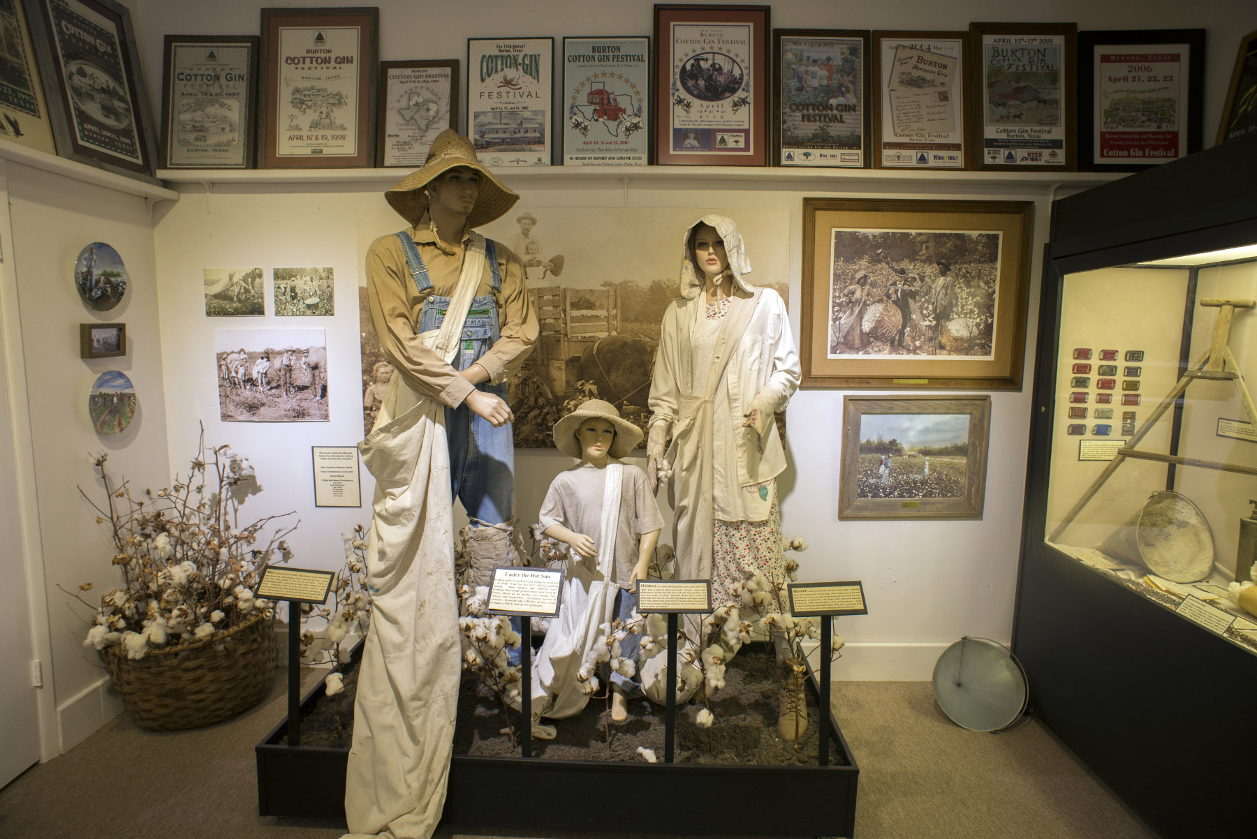
Texas Cotton Gin Museum in Burton. Photo by Kevin Stillman.
Even though COVID-19 restrictions have been eased, and more and more people are able to receive vaccines in the state, there is still a need to play it safe. For Texans, that means taking a day drive, where you can get out and about, see some beautiful spring scenery, spend time outdoors, grab a bite at a local favorite, and have a good time with minimal contact with other people. With increasing daylight, here are few drives you can do in a single day, or plan the way you like.
Over the coming weeks, we will be giving you more spring road trips to enjoy in different parts of the state.
View from the Rainbow Bridge crossing the Neches River. Photo by Kevin Stillman.
Houston to Shangri-La Botanical Gardens and Nature Center in Orange
Trip Time: About 5-6 hours
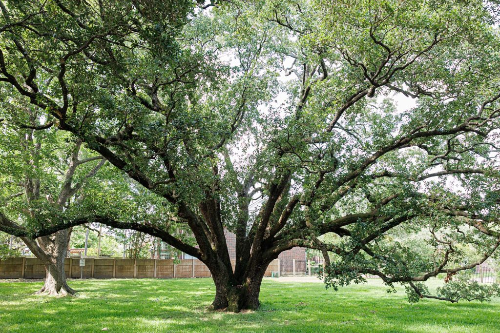
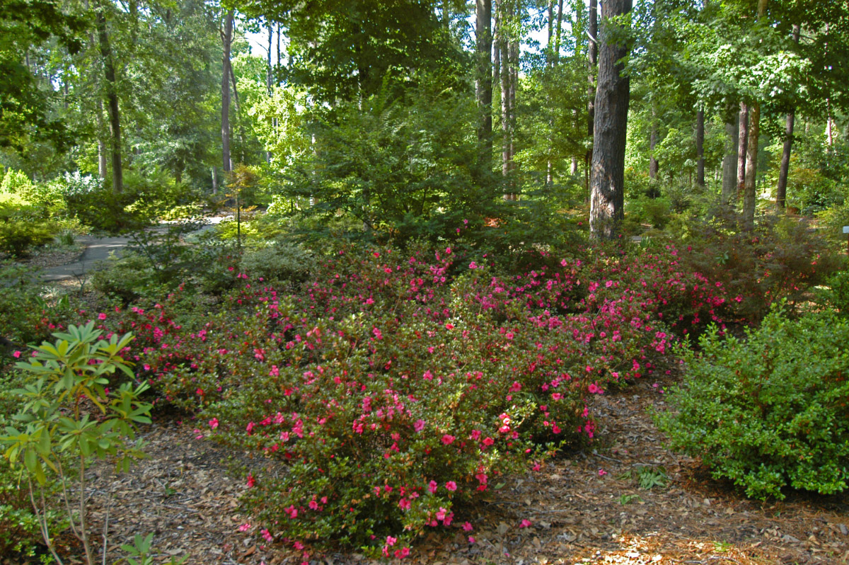
You want guaranteed greenery and blooms? Get out of Houston, and head east before the summer heat and humidity set in.
Take US 90 to Liberty, about 45 minutes, then turn north on State Highway 146 and drive 8 miles to Hardin. Head east on Farm to Market Road 834, turning north on Farm to Market Road 770, and prepare to go east again on 105 for 18 miles to Saratoga, birthplace of the country music giant George Jones. Continue east for 17 miles on FM 770 to State Highway 326 to Kountze, the seat of Hardin County and headquarters of The Big Thicket National Preserve. From Kountze, drive south on US 287 to State Highway 327. In 9 miles, you’ll hit Silsbee. Continue east 7 miles on US 96/Farm to Market Road 2246 to Evadale. It’s 30 miles south to Orange on FM 2246 and State Highway 62.
This route passes through some of the densest remnants of The Big Thicket—where swamp meets hardwood forest—but the destination you want is the Shangri-La Botanical Gardens and Nature Center and its 250 acres of lush vegetation, including a massive azalea garden, alongside Adams Bayou. Shangri-La was dreamed up by lumber baron H.J. Lutcher Stark in the 1930s and ’40s, and the Lutcher Stark Foundation stewards the manicured gardens, landscaped ponds, epiphyte house, azalea garden, bird blinds, and walking trails as a gift to the people of Southeast Texas. And it’s all free of charge for visitors.
Loop back on US 87 and State Highway 73 through Bridge City and over the storied Rainbow Bridge 20 miles to Port Arthur. After cutting through the heart of the Port Arthur refinery, the biggest in Texas, stop for some takeout at Big Doobie’s Boudin and Cracklins food truck on Port Arthur Road before cutting west across the rice prairie for 27 miles to Winnie. From Winnie, either head home on Interstate 10, or detour on State Highway 124 for 18 miles south to High Island. It’s spring and High Island happens to be one of the world’s premier birding spots during migration. The town’s four sanctuaries—Boy Scout Woods, Smith Oaks, Eubanks Woods, and Gast Red Bay—are open year-round. Smith Oaks is particularly spectacular as a rookery for breeding herons, egrets, and bright pink roseate spoonbills.
The Ruby M. Mize Azalea Garden and the Mast Arboretum are found at Stephen F. Austin University in Nacogdoches. Photo by Stan A. Williams.
The East Texas Azalea Loop
Trip Time: About 7-8 hours
Tyler and Nacogdoches are the end points of this Azalea to Azalea loop, showcasing the iconic blooming red, pink, and white rhododendron shrubs that thrive throughout East Texas.
From Dallas, drive to Tyler, about 100 miles via US 175 through Brownsboro and Athens on State Highway 31, then head to Nacogdoches. From Houston, go the Interstate 69/US 59 to Nacogdoches (142 miles). With this trip, you can choose your journey.
With a population of 105,000, Tyler is the biggest city in East Texas and is famous for its municipal rose garden. It has a designated 10-mile trail through neighborhoods of distinctive early- and mid-20th century residences, all showing off their azaleas. Nacogdoches is home of the Ruby M. Mize Azalea Garden—the largest in Texas—on the campus of Stephen F. Austin University. Its Azalea Trails cover 25 miles. In between the major highways connecting Tyler and Nacogdoches are backroads through lush Piney Woods and dense hardwood river bottoms.
From Tyler, take State Highway 110 for 35 miles south through Whitehouse (home of football star Patrick Mahomes and the Blackhawk Creek Hike and Bike trail), Troup, and New Summerfield to Ponta, home of the Cherokee Trace Drive-Thru Safari, where you can take a self-guided tour through 300 acres featuring exotic and endangered species. Pick up State Highway 204 to Reklaw, Cushing, Trawick, and US 259 into Nacogdoches, 75 miles from Tyler.
Nacogdoches, a large small town of 35,000, calls itself the Garden Capital of Texas because of its gardens, the Pineywoods Native Plants Center, nurseries, herb farms, pick-your-own farms, walking trails, parks, a zoo, and birding site. The downtown of the Oldest Town in Texas warrants a walkthrough as does the Sterne Hoya Museum and Library. There are numerous eateries for takeout including Liberty Bell, Appleby Sand Rd Mercantile and Café, Butcher Boys Smokehouse and Deli, Clear Springs Restaurant, and Dolli’s Diner.
You want backroads? From the north side of Nacogdoches, head back to Tyler via Farm to Market Road 343, then north on Farm to Market Road 225 for 23 miles to the railroad town of Cushing. Continue north on FM 225 for 11 miles to Laneville, then west on Farm to Market Road 1798 and north on State Highway 42 for 22 miles to Turnertown. Four miles north on SH 42 is New London, site of one of Texas’s biggest disasters, the 1937 natural gas explosion that blew up the town’s school, killing more than 290, including students and teachers. A cenotaph and museum across the road tell the story of the tragedy.
Take 25 miles back to Tyler through Overton on State Highway 323, then Farm to Market Road 850 and State Highway 31. Tyler has all the amenities of a city: the Caldwell Zoo, a waterpark, the Discovery Science Center, and museums dedicated to art, roses, local history, aviation, railroads, and ranching. There are outdoor dining options galore including the Texas City Music Grill and Smokehouse, Lago del Pino lakeside Mexican eatery, The Grove Kitchen and Gardens, Stanley’s Famous Pit BBQ, and Rick’s On The Square.
Texas Independence Day Celebration at Washington-on-the-Brazos Historic Site. Photo by Will van Overbeek.
Independence Loop
Trip Time: About 6 hours, depending on stops
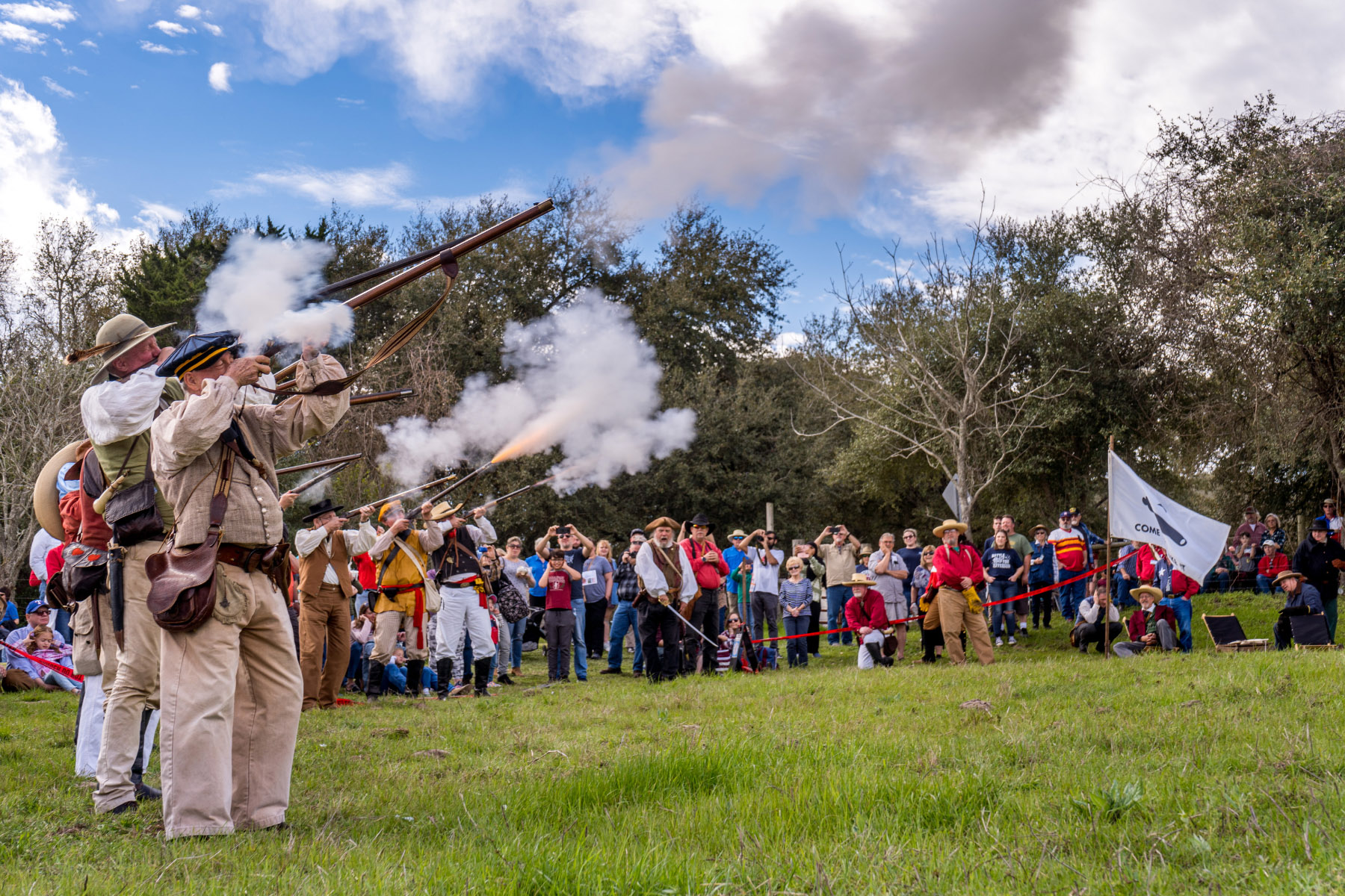
Want to see bluebonnets (regardless of drought conditions) as well as wine cups, Indian blankets, bluebells, and other blooming spring wildflowers? Head to Washington County, the birthplace of the Republic of Texas.
Start in Burton on US 290, 85 miles west of Houston and 77 miles east of Austin. Burton is home of the Texas Cotton Gin Museum, open Tuesdays through Saturdays, and one of the few functioning cotton gins of its era, both testaments to the role cotton played in this part of the state. The gin fires up during Burton’s Cotton Gin Festival the third Saturday in April.
Head out of Burton on Farm to Market Road 390, the historic La Bahia Trail, for about a mile, then take a left onto Farm to Market Road 1948 for 8 miles leading to scenic views of the south shore of Lake Somerville through some sweet countryside.
When you hit State Highway 36, go south another mile, then east on FM 390 for 7 miles to the ruins of Old Baylor College and the town of Independence. Continue east on FM 390 for three miles to William Penn, where the road takes a sharp turn south to State Highway 105, 5 miles south. Turn northeast on SH 105 and go 2 miles, veering right onto Farm to Market Road 912 for 3 miles to Washington-on-the-Brazos Historic Site where the Republic of Texas Declaration of Independence was signed. The park encompasses the La Bahia Historic Pecan Tree overlooking the old ferry crossing where the Navasota and Brazos rivers meet; the Barrington Plantation State Historic Site, the homestead of Anson Jones, the last president of the Republic of Texas, is now a demonstration farm; and the Star of the Republic Museum.
For a quick detour, go north on Farm to Market Road 424, aka Old Highway 105, for a couple miles back to SH 105. “This road is along bottoms between the Brazos and Navasota rivers,” says musician Rob Moorman, who has lived in the Brenham area for 55 years. The bottoms he refers to are the richest soil there is, soil that is deposited by floods and therefore is exceptionally productive for food crops as well as wildflowers. “There are huge sunflower fields that are pretty amazing.”
From Washington-on-the-Brazos, take FM 912 west for not quite a mile before turning south on Farm to Market Road 1155, cruising through open country for 16 miles to the town of Chappell Hill, a small community of 600 dating back to 1849 and located in Stephen F. Austin’s original colony. Pick up a brochure at the Chappell Hill Historic Museum (open Wednesdays through Sundays) for self-guided walking and driving tours. The Chappell Hill Circulating Library is definitely worth a look.
Continuing on your trip, from Chappell Hill travel west on US 290. Detour south on Wonder Hill Road, which turns into Phillipsburg Church Road, for a bite to eat at The Kenney Store in Phillipsburg. Serving an expansive menu (everything from burgers and tacos to pizza and chicken-fried steak to salads and pie) in a spacious outdoor dining area, it’s the perfect spot to treat yourself after a scenic historic drive.
Finally, get back on 290 and head to Brenham, the Washington County seat and a bubbling small town of 15,000. Brenham’s compact well-preserved downtown is worth a stroll, as are the Antique Rose Emporium for a fragrant walk-through and Toubin Park downtown, where artifacts tell the town’s 19th-century history.
Caveat: “We’re not as mask conscious out here as ‘city folk’ for whatever reason,” Moorman says, acknowledging that “It can be disconcerting for some visitors.”
Colorado Bend State Park. Photo by Will van Overbeek.
Colorado Bend-San Saba
Trip Time: About 8-10 hours
The Hill Country may get all the love (and most of the visitation) but push a little farther beyond the fringe and a wild river and a swinging bridge are calling.
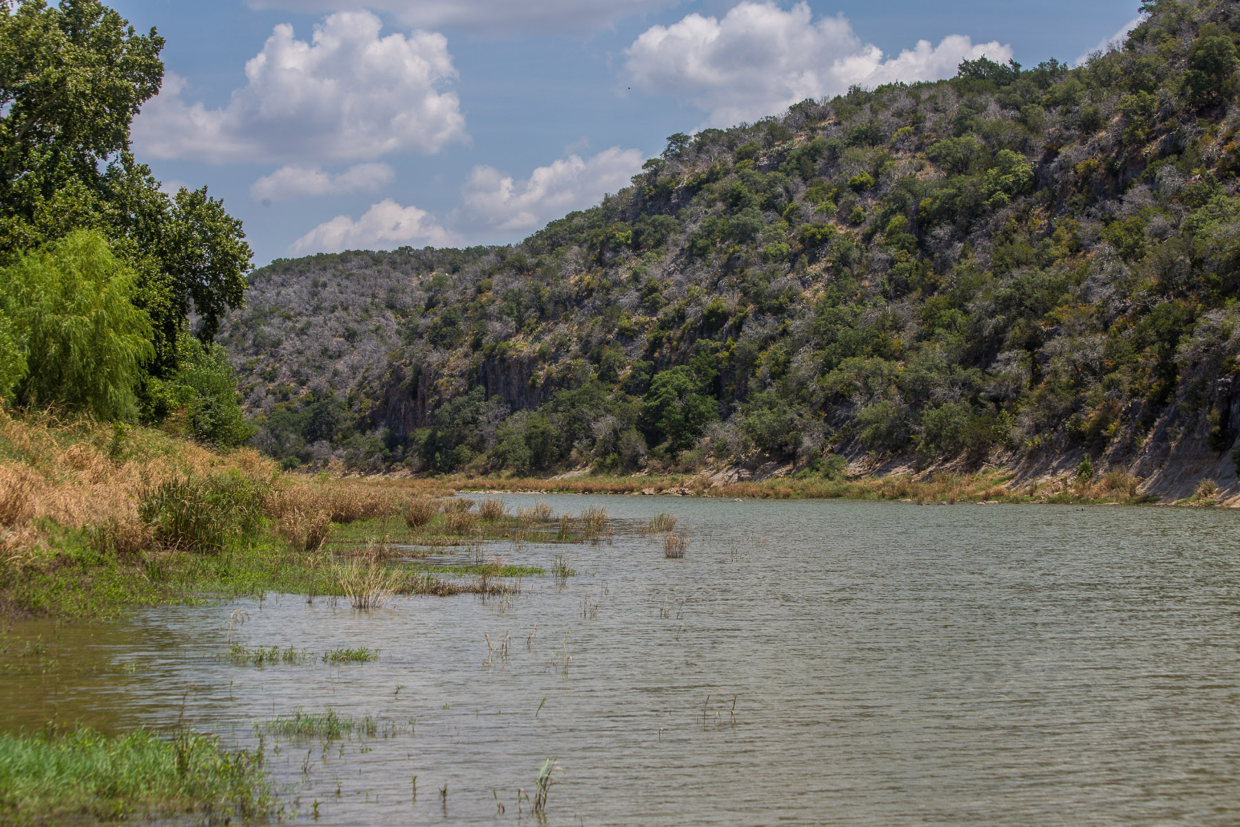
Start in Lampasas, 80 miles northwest of Austin and 140 miles southwest of Fort Worth. This is a good place to gas up, get your bearings, grab a Storm’s hamburger, and head west 24 miles on Farm to Market Road 580 to Bend. Follow the signs 4 miles (2 miles are unpaved) to the entrance of Colorado Bend State Park. Avoid the six additional miles of caliche road to headquarters and reserve your day trip spot online ($5 admission), print your permit, and put it on your dash.
Colorado Bend is the last undammed stretch of the Colorado River before it empties into Lake Buchanan. The park’s main draws in pandemic times are 35 miles of hike-and-bike trails throughout the park’s rocky canyonlands terrain; a self-guided walk to Gorman Falls, a 70-foot fern-choked spring-fed waterfall; and 6 miles of Colorado River riverfront for fishing (bass are abundant; no fishing license required), wildlife observation, and paddling (sit-on-top kayaks are available for rent). Tours of some of the park’s 400 caves are temporarily suspended. Colorado Bend is also prime territory to spot endangered golden-cheeked warblers and black-capped vireos songbirds.
On her trips to Colorado Bend, Austin-based photographer Jennifer M. Ramos, a big fan of state parks, makes the Gorman Falls hike a priority. “It’s a fun hike,” she says. “The varieties of cactus and the rocky paths keep it interesting. The waterfall itself, as a destination, is worth the risk of rolling an ankle. It’s tall and lush, and sometimes you can catch the sun coming through at just the right angle. That’s a 3-mile, round-trip hike (out and back) so it takes about one and a half hours.”
Ramos enjoys the early spring cacti blooms. “My favorite is the claret cup. I saw more of that along the Windmill Trail, which is roughly the same length as the Gorman Falls Trail, but not as challenging. It’s more of a savannah. Since most people stick to Gorman Falls and Spicewood Springs trails, the latter for its swimming-hole feature, it’s easy to avoid people on most other trails.”
Circle back to Bend and the Bend General Store, a laidback joint that functions as a café serving burgers, fried chicken, catfish, wraps, gyros, pizza, salads, breakfast, and beer, with an outdoor dining area, and as an all-purpose general store and gathering place complete with groceries, live minnows for bait, a pool table, exceptional live music, dogs on the porch, cabins for rent—but no gas.
From Bend, continue west 29 miles to San Saba, the Pecan Capital of the World. Twenty-eight million pounds of the state nut are shelled here annually, with seven specialty shops selling pecans in all forms and fashions including roasted, chocolate-covered, and baked in a pie. Wallace Street, which has two wineries, a bakery, an olive oil shop, and several restaurants, offers plenty of shopping and indulging options.
Mill Pond municipal park and San Saba River Nature Park provide access to the San Saba River.
Head north of town on State Highway 16 for a mile, veering left Farm to Market Road 500 for about 9 miles, then right on San Saba County Road 137 to where it intersects with Mill County Road 433 for a bridge like none other around these parts. The Regency Bridge (the Swinging Bridge as it is called around San Saba) is a one-lane suspension bridge spanning the Colorado River, completed in 1939 and the last of its kind. Walk across the wooden deck and the bridge swings enough to provide plenty of cheap thrills.
To return to Fort Worth, continue north till you hit Farm to Market 432, turning east on Farm to Market 574 and 5 miles to Goldthwaite, where you can pick up Farm to Market 2005 and eventually reach US 67 East. Fort Worth is 136 miles away. To return to Austin, go west on Farm to Market 500 for 5 miles, then south on Farm to Market 45 to Richland Springs. It’s 120 miles via US 190.