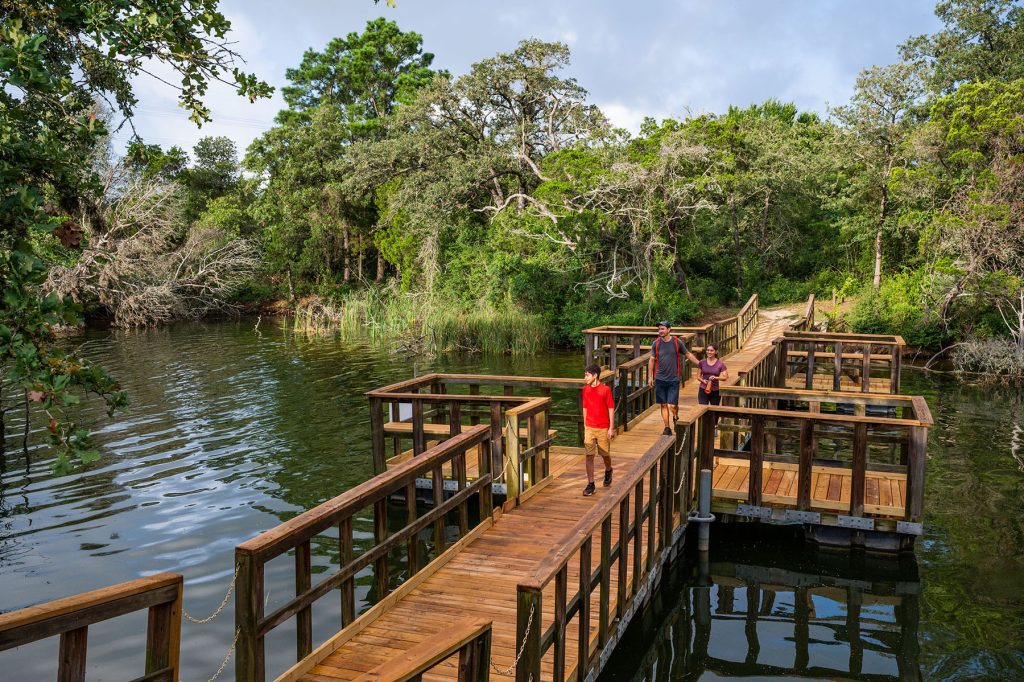
A boardwalk along Lake Bastrop provides viewing and fishing areas for visitors at the Lake Bastrop North-South Trailway. Photo courtesy LCRA.
When my dog and I go hiking, I try to find trails that meet three criteria. They need to be at least 4 miles long, have some sort of bathroom situation, and be wide enough that I can see any snakes before Jessie does.
Jessie, my 5-year-old chocolate Lab, has only one requirement: smells. Lots of smells.
On a recent sunlit Saturday, we hiked a path that checked all the boxes: the Lake Bastrop North-South Trailway. About an hour from Austin—or Bryan or San Marcos—the trail connects the North Shore Park and South Shore Park on Lake Bastrop. Both parks, and the trailway, are on land owned by the Lower Colorado River Authority, which operates the power plant for which the lake was built.
Jessie and I arrive at the South Shore Park on a spectacular March afternoon (70 degrees, a cloudless sky, just enough breeze to ruffle the trees). After paying our day-use fee of $5 and picking up a map at headquarters, we park at a picnic area at the edge of the lake. Jessie discovers a forgotten Cheeto in the dirt. We inadvertently skip the first thousand feet of the 4.5-mile-long trail, not realizing it starts on the other side of the parking lot, and begin our hike behind the brightly colored (and dog-friendly) lakeside cabins.
At first, the path is a typical Central Texas trail (that is, rocky, flanked by oak and Ashe juniper) with a few pine trees mixed in. But as we leave the South Shore Park behind, the landscape becomes more identifiable as the Lost Pines. Tall loblollies stretch toward the sky, shading the path; a carpet of pine needles over the red dirt softens our footfalls. Jessie at first darts from side to side, sniffing, before settling into an eager trot. The trail is plenty wide enough for snake spotting.
Other LCRA Parks
Find a full list at lcra.org/parks.
Canyon of the Eagles Nature Park and Resort
Burnet
The park has campsites and television-free, pet-friendly guestrooms on Lake Buchanan. The Overlook restaurant, with panoramic views of the lake, serves breakfast, lunch, dinner, and Sunday brunch. The property includes 16 miles of nature trails and the Eagle Eye Observatory for astronomy buffs.
McKinney Roughs Nature Park
Cedar Creek
Tackle 9 miles of hiking trails over steep hills and along the river. A zipline course (reservations required here) offers dramatic aerial views, and lodging and meeting facilities accommodate weddings and events.
Lake Fayette Oak Thicket Park
Fayetteville
Guests can swim in Lake Fayette and camp in a tent or RV or book one of eight cabins with fridges, microwaves, and coffee pots.. A 3-mile trail connects Oak Thicket to Park Prairie Park, also located on the lake, which is a cooling reservoir for LCRA’s coal-fired power plant.
Matagorda Bay Nature Park
On the coast between Galveston and Port Aransas
Located where the Colorado River flows into the Gulf of Mexico, the park allows visitors to enjoy birdwatching; mini golf; kayaking; and RV, tent, and Airstream camping.
As we walk, we hear the reedy click-click-click of grasshoppers vaulting out of our way. Cardinals call to one another in the treetops. We cross several dry creek beds, but below one bridge we can just make out an audible trickle of water. What we don’t hear: civilization. For two-thirds of the hike north, the trail is far enough from any road that we are immersed in a deep, restorative quiet. I feel the clutter in my chest and shoulders, the accumulated stress of the week, begin to dissolve.
About halfway to the North Shore, the trail takes us right by the Lake Bastrop dam—part of the reason this park exists. The Texas Legislature created the Lower Colorado River Authority in 1934 to build dams along the Colorado River to manage flooding and generate hydroelectric power. By the mid-1960s, with Central Texas’ population increasing, the LCRA opted to add another source of electric power. It built the first natural gas-fired units at the Lost Pines Power Park, along with Lake Bastrop to cool them, just over 3 miles from where the Colorado River snakes through Bastrop.
The LCRA needed large amounts of land to construct its dams and power plants. Once the projects were complete, much of the land remained undeveloped, although it was used informally and often illegally for recreation. Privately operated waterfront parks offered public access to lakes Buchanan and Travis as early as the 1940s, but the parks on Lake Bastrop were the LCRA’s first effort at developing the agency’s land—with trails, campsites and cabins—for public recreation. Both parks opened in 1968 (the trailway was constructed in the early 2000s).
Eventually, in the 1990s, the LCRA sold some leftover land and bought better-situated property for more parks along the Colorado River—from San Saba in the Hill Country to Matagorda Bay at the Gulf Coast. Today, there are more than 40 such parks, about half operated by the LCRA and half by cities, counties or private companies.
At the dam, Jessie and I make a short detour up the steep embankment. We stop to watch the wind-wrinkled water lap against the rocky shore while a flock of pied-billed grebes sit atop the rolling waves, motionless as decoys. Dragonflies flit through the air. Jessie finds a promising patch of grass and executes her signature move: a sniff of the dirt that seamlessly transitions into a collapse onto her side followed by a good roll on her back, her legs kicking wildly.
Back on the trail, we soon arrive at the floating bridge, a short boardwalk atop an inlet of water, and begin to hear cars on Farm-to-Market Road 1441, which skims the north end of the park. At a fork in the trail, we follow the path marked Buzzard Point—a choice that adds an extra half mile to our journey and is aptly named. A kettle of buzzards wheels slowly on the thermals just offshore.
I’m able to check off the second of my criteria with a visit to the bathrooms at the North Shore Park. After listening to two men with a pickup truck curse as they struggle to back their trailer down the boat ramp, we rest at a picnic table and eat a snack while considering the park’s (pet-friendly!) safari-style tents, visible through the trees. Jessie scours the ground for Cheetos but comes up short. We then make our way back south.
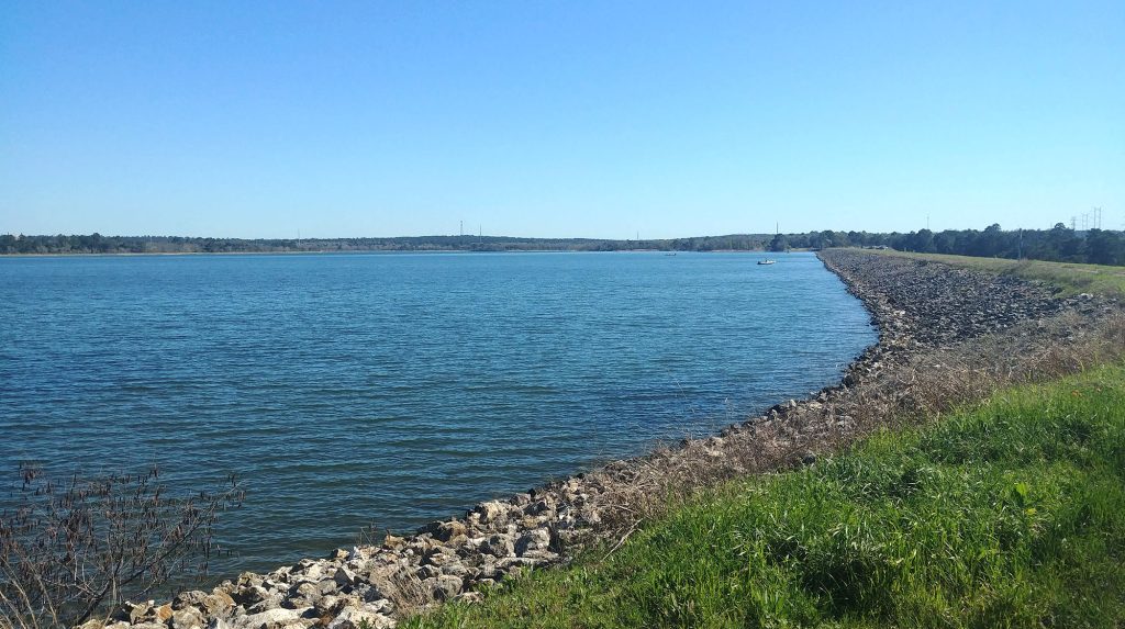
The shore of Lake Bastrop, a reservoir built by the Lower Colorado River Authority in the 1960s. Photo by Robyn Ross.
As we near the end of the trail, the industrial towers of the distant Lost Pines Power Park are visible through the trees. Jessie and I emerge from the woods into South Shore Park with about an hour of daylight left. We’ve hiked just over 9 miles, and we’re tired but feel accomplished. It was a long hike, mostly flat, with a few short, steep hills to wake up the quads. I am astonished that on this beautiful day, on the entire round trip, we passed only one family of hikers and three mountain bikers. We pile into the car to head for home, resolving to return when we can stay the night in a cabin, lulled to sleep by the crickets and frogs.