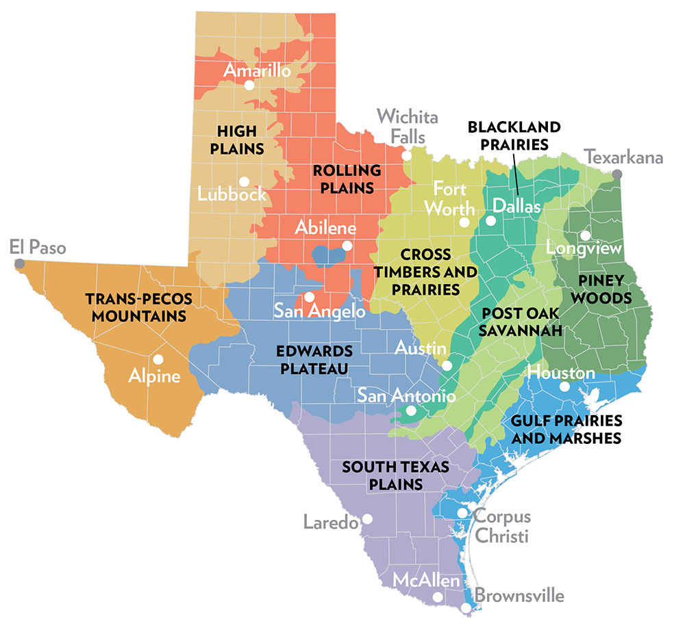
Source: Gould, F. W. Hoffman, G. O., and Rechenthin, C. A. 1960. Vegetational areas of Texas, Texas A&M University. Texas Agricultural Experiment Station, Leaflet No. 492 (here modified by the Texas Parks and Wildlife Department).
Texas has more than 268,000 square miles of land and water with variations of climate and topography that result in wildly diverse habitats. The state’s vegetational areas are generally broken into 10 natural areas (ecoregions). There are a number of parks and preserves where travelers can view native plants of the ecoregion and enjoy wildflowers in the spring.
PINEY WOODS is an area of rolling terrain with pines, oaks and tall hardwoods in the east to northeastern part of the state. The four national forests and the Big Thicket Nature Preserve manage and protect habitats characteristic of this ecoregion. Wildflowers
can be found in the Matlock Hills and Sandy Creek Ravines of Sabine National Forest, Black Branch Barrens and Boykin Springs of Angelina National Forest, and five units of the Big Thicket.
GULF COAST PRAIRIES AND MARSHES region runs along the Texas coastline from Orange to South Padre Island. It includes barrier islands, salt grass marshes, oak parklands and river bottomlands. Padre Island National Seashore and nine national wildlife refuges protect the coastal plants and wildlife. Wildflowers at Padre Island include Rio Grande phlox, Texas prickly pear, sea lavender and beach evening primrose.
POST OAK SAVANNAH stretches from the northern part of South Texas to north of Texarkana. It is a transitional area for plant and animal species that is typified by oak woodland interspersed with grasslands. Lake Somerville State Park contains post oaks, and the trailway passes through yaupon, post oak, hickory, black jack oak and water oak forests. Though not in this ecoregion, the Post Oak Preserve in Seagoville protects one of the last stands of Post Oak Savannah.
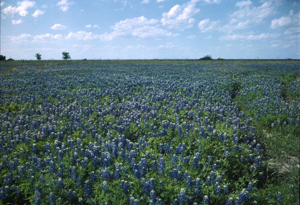
BLACKLAND PRAIRIES is named for the deep, fertile black soils. This region consists of a gently rolling landscape with most vegetation related to farming and ranching. Remnants of the Blackland Prairies are preserved in the Clymer Meadow Preserve (appointment only) in Hunt County, Parkhill Prairie in Collin County, Cedar Hill State Park in Cedar Hill and Rosehill Park in Garland. Wildflowers at Cedar Hill include bluebonnets, antelope horns, bluebell and fleabane.
CROSS TIMBERS AND PRAIRIES ecoregion is marked by dense areas of trees combined with irregular plains and prairies. It is west of the Blackland Prairies and northeast of the Edwards Plateau. Tandy Hills Natural Area in Fort Worth protects the native prairie with more than 500 native wildflower and plant species. The Bob Jones Nature Center and Preserve in Southlake protects the eastern Cross Timbers ecosystem on about 750 acres.
SOUTH TEXAS PLAINS is filled primarily with thorny brush/scrub mixed with grasslands and, in the Rio Grande valley, subtropical woodlands. The land ranges from nearly level to rolling plains. Choke Canyon State Park has dense thickets of mesquite and blackbush acacia that are often joined by abundant wildflowers in the spring.
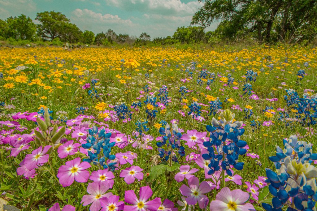
EDWARDS PLATEAU is known for springs, stony hills and steep canyons. This Central Texas area has juniper/oak woodlands, mesquite savannah and some grasslands. The Balcones Canyonlands National Wildlife Refuge, Inks Lake State Park and Enchanted Rock State Natural Area are among the parks that nurture the natural habitat of this region and offer brilliant wildflower shows during the spring.
HIGH PLAINS ecoregion, in the Panhandle, is characterized by a high plateau separated from the Rolling Plains by the Caprock Escarpment. Its vegetation is primarily cropland with mesquite and juniper. The Buffalo Lake National Wildlife Refuge preserves shortgrass prairie with wildflowers, like poppies, flowering cactus and sunflowers blooming from April through early June. Muleshoe, the state’s oldest national wildlife refuge, also protects the shortgrass prairie.
ROLLING PLAINS ecoregion is cut into gently rolling hills and broad, flat areas by several rivers and numerous tributaries. This portion of the Panhandle resembles a mesquite-shortgrass savannah. Around Lake Meredith National Recreation Area,
travelers will find the Shortgrass Prairie Ecosystem and, in the spring, wildflowers such as Blackfoot daisy and chocolate daisy.
TRANS-PECOS MOUNTAINS ecoregion in West Texas is considered a complex region, ranging from desert valleys with creosote-tarbush desert scrub to mountain slopes with pinion pine, junipers and oaks. Big Bend National Park, Franklin Mountains State Park and Guadalupe Mountains National Park conserve portions of this natural habitat and offer wildflowers, including two- to three-foot-tall bluebonnets, Mexican gold poppies and late-blooming perennials, respectively.
Ecoregion source: Texas Parks and Wildlife Department, tpwd.texas.gov.